

Moisture increases and smoke decreases by midweek
Sunday, August 29, 2021
Temperatures are close to eighty degrees under sunny but smokey skies in the Steamboat Springs area early this Sunday afternoon. While Category 4 hurricane Ida impacts Louisiana today and will not affect our weather, moisture from Category 1 hurricane Nora currently off the Pacific coast of Mexico is expected over our area by midweek leading to the possibility of moderate to heavy rain.
Winds from the west have transported smoke from the California wildfires over our area starting yesterday, with the NOAA smoke plume model keeping the smoke around through the entirety of its forecasting range, which ended early Tuesday.
A storm currently developing in the Gulf of Alaska is forecast to cross the Pacific Northwest coast Tuesday morning, with the winds turning ahead of the storm to be from the southwest over our area by Wednesday. My guess is there won’t be enough southwesterly flow on Tuesday to move the smoke from our area, so expect another smokey day with continued warm temperatures in the eighties, which is above our average high temperature of 78 F.
The weather gets far more interesting by Wednesday as the southwesterly flow ahead of the Pacific Northwest storm steers moisture from what will then be the remnants of Nora over our area. Coincidentally, a piece of the Pacific Northwest storm is left behind off the coast of California which may be a player in our weather for late in the work week and next weekend.
In any event, Wednesday will likely start warm similar to the last few days, with hopefully far less smoke which should be gone by the afternoon as the chances for showers increase. High temperatures will also be held in check by the increasing cloud cover, so highs several degrees below average are expected.
By Wednesday night, weather forecast models have the possibility of moderate to heavy rain increasing as the remnants of Nora move overhead or nearby. The track is still uncertain as the hurricane is now forecast to move northward closer to the mainland than Baja, and this will influence the track of the heaviest moisture.
But weather forecast models agree that we will see a much cooler and showery Thursday, with high temperatures struggling to break out of the sixties. There is a fair bit of uncertainty for the weekend as that leftover piece of energy off the coast of California may move inland and contribute to another push of monsoonal moisture from the south, so stay tuned as I’ll certainly know more about that by my next regularly scheduled weather narrative on Thursday afternoon.
Showers today ahead of a warm, sunny and possibly smokey weekend
Thursday, August 26, 2021
Temperatures in the upper seventies and a mix of clouds, sun and showers are over the Steamboat Springs late this Thursday afternoon. The chances for additional showers will persist through this evening before skies clear yielding warm and sunny weather for the weekend, along with the possibility that smoke from the California wildfires returns to our area
A quick moving storm currently over Utah has turned our winds to be from the south, allowing monsoonal moisture to overspread Colorado and bring showers to our area. The showers will end by around midnight as the storm passes through our area and will be followed by much drier air ahead of another storm currently crossing the Pacific Northwest coast.
That storm is forecast to be deflected to our north on Friday and Saturday by a strengthening ridge of high pressure centered over the Southeast, bringing breezy winds from mostly the west, sunny skies and warm temperatures five or more degrees above our average high of 78 F.
While the NOAA smoke plume model forecasts some smoke mostly to the north of our area on Friday, it currently has much higher smoke concentrations predicted for Saturday. While the model only forecasts out to two days, continued breezes from the generally west direction on Sunday may keep the smoke around under continued sunny skies and warm temperatures.
Meanwhile, there are two tropical storms that may develop into hurricanes this weekend, with Ida forecast to impact the western Gulf Coast and Nora forecast to impact the Baja peninsula. While Ida will not affect our weather, there may be a chance we will see either some moisture from Nora or even the remnants of the storm itself in about a week.
Stay tuned to my next regularly scheduled weather narrative on Sunday afternoon where I’ll discuss the continued warm and dry conditions to start the work week and the possibility for increasing moisture to welcome the month of September.
Pleasant weather for the coming work week
Sunday, August 22, 2021
Temperatures are currently in the low seventies under mostly sunny skies in the Steamboat Springs area this Sunday noon. While clouds will come and go and temperatures warm toward the eighties in the coming days, rain chances will be minimal until later Thursday when a fast moving wave to the north grazes our area.
After the excitement of significant rainfall and the first snow of the 2021-2022 ski season at the Steamboat Ski Resort to end the last work week, the weather for the upcoming work week will be far more benign and quite pleasant. Some cool air associated with a wave currently entering the Dakatos will keep our temperatures in the seventies today, a few degrees below our seasonally declining average of 79 F, along with some breezy winds generally from the west.
The NOAA smoke plume model has the southern edge of a ribbon of smoke mildly degrading air quality later this afternoon, but winds turn to be more from the southwest by tonight and push the smoke from our area. Incidentally, the GEOCOLOR satellite movie clearly shows the ribbon of smoke just to our north that is expected to briefly bulge southward over our area this afternoon.
Winds from the southwest ahead of an area of low pressure that is forecast to cross the Pacific Northwest on Tuesday are forecast to raise our temperatures several degrees to around average and keep breezy conditions around through midweek.
That area of low pressure will not move much through the work week as waves of departing energy are replaced by additional waves of incoming energy. By Thursday, forecasts are for one of these waves to be strong enough to turn our winds to be a bit more from the south, which may carry some monsoonal moisture northward over our area and modestly increase the chance for some showers later Thursday and possibly overnight.
Next weekend is currently looking nice, though some sort of tropical storm looks to travel through the Caribbean Sea this week and then possibly the southern Gulf of Mexico which may eventually increase moisture over our area after next weekend. Stay tuned to my next regularly scheduled weather narrative on Thursday afternoon to see if the forecast for a nice weekend holds.
First snow of the season!
Friday, August 20, 2021
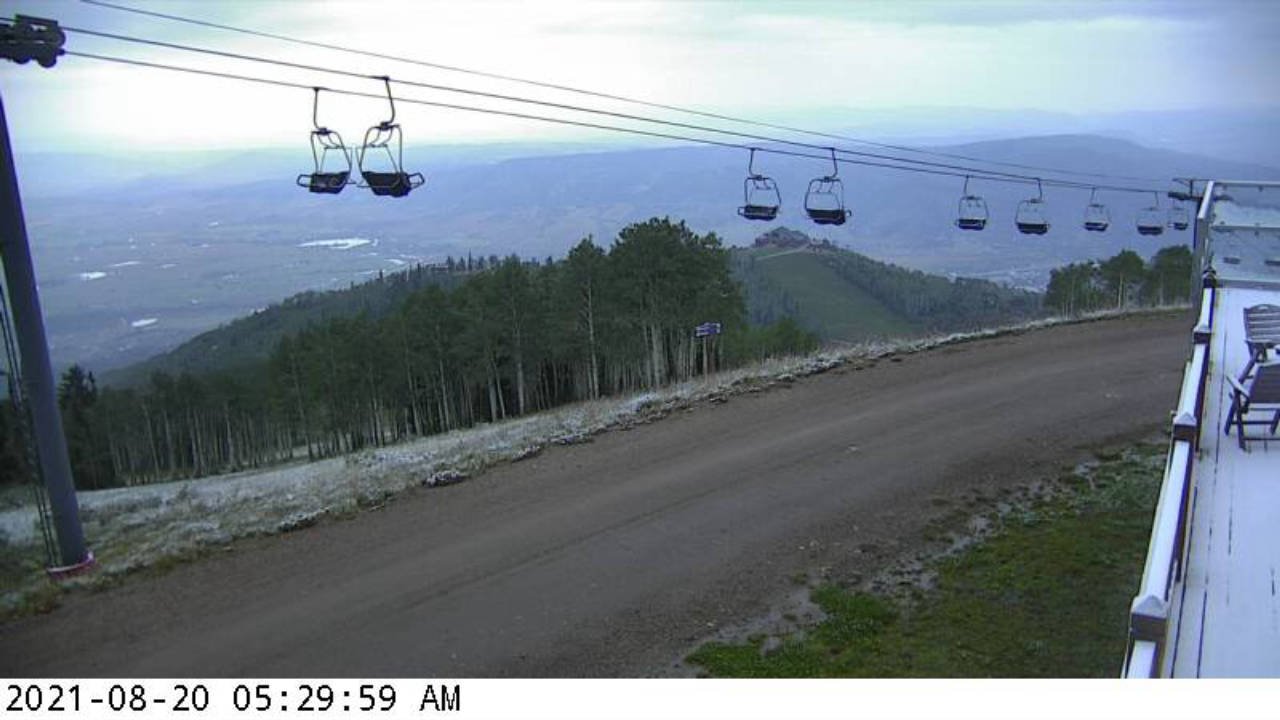
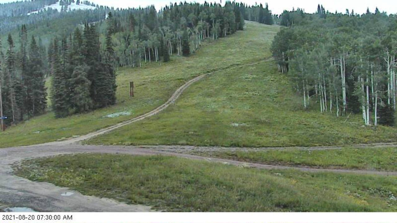 Just a quick update to yesterday’s weather narrative to mention that as of this morning, 20 August, the Steamboat Ski Resort has received its first snowfall of the 2021-2022 ski season!
The final push of cold air associated with the storm came through around midnight last night, and dropped temperatures at the Storm Peak Lab near the top of Mt. Werner to 29 F.
Shown in the two pictures from early this morning is snow on the deck of Four Points and the top of Twister and a patch of snow near the top of High Noon taken from the Rendezvous cam.
Also, in addition to the rainfall totals from yesterday morning, areas around town received another three to four tenths of an inch of rain, with 0.44” reported near the top of Steamboat Boulevard.
Taste of Autumn
Thursday, August 19, 2021
Temperatures are in the mid-sixties this Thursday afternoon with a mix of some sun and clouds over the Steamboat Springs area after a rainy morning. A cold fall-like storm currently in Utah will swing through our region overnight bringing more rainfall and even a dusting of snow at the higher elevations. While similarly cool temperatures will persist for Friday, they’ll warm through the weekend and the following work week under mostly sunny skies.
The center of a quite cold storm by mid-August standards is on our doorstep, with significant rainfall ahead of the storm being reported around town this morning. Between two and four tenths of rainfall was reported across the region as of 7 am this morning, with that much or more expected by tomorrow morning as waves of energy and moisture associated with the storm move overhead through tonight.
The coldest air will not be overhead till early Friday morning when most of the moisture will have passed, but snow levels will be low enough for a dusting of snow at the higher elevations. There may even be snowflakes on top of Mt. Werner, though unfortunately the Steamboat Powdercam is not currently active to verify that. Feel free to comment in this blog if you happen to be camping at the higher elevations and see this ski season’s first snowfall!
While precipitation will be over early Friday, the air mass will be slow to recover and again we will see high temperatures in the sixties on Friday, around ten to fifteen degrees below our average of 80 F, though with lots of sun.
The weekend is looking quite pleasant, with temperatures recovering into the seventies even as another storm is forecast to cross the Pacific Northwest coast Friday night. However, a ridge of high pressure centered over the southeast will deflect the storm to our northwest, but not before some increasing winds later Saturday along with the slight chance of some afternoon and overnight showers.
The ridge of high pressure elongates to the northwest and over our area by the beginning of the work week, leading to mostly sunny skies and temperatures warming to around average which persist through midweek, along with some breezes. There is very dry air lurking to our west, though that is forecast to battle the monsoonal moisture traveling northward along the west side of the high pressure, so there may be a small chance of a late-day shower, or not, depending upon the daily outcome of that battle.
Another storm is forecast to cross the Pacific Northwest midweek, but again the forecasts are for the storm to deflect around our area, and right now it looks like we will see dry weather with some more breezes to close out the work week. Stay tuned to my next regularly scheduled weather narrative on Sunday afternoon for any updates to the pleasant weather forecast.


