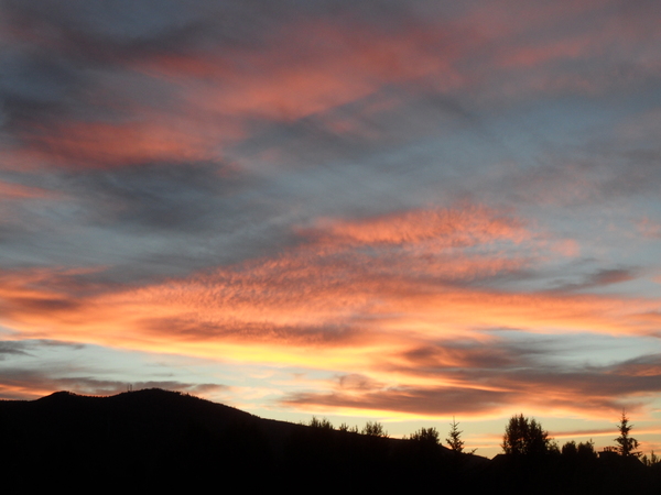
Chances for snow each day for the rest of the year
Sunday, December 26, 2021
Gusty winds and falling temperatures are over the Steamboat Springs area early this Sunday afternoon as the next winter storm moves overhead. Snows will diminish after the storm later tonight, but might not completely end as the atmosphere remains unsettled ahead of our next colder storm for Monday night and early Tuesday. The unsettled weather looks to remain overhead for the duration of the year and may be punctuated by what seems to be our annual storm to start the new year.
The winds picked up when cold air started filtering into our area around 11 am, with sustained speeds of 45 mph and gusts to 70 mph observed at the top of Mt. Werner at 1 pm. The snows have now started, and combined with the wind will make for difficult travel at all elevations as blowing snow obscures visibility and creates slick roads. Expect 2-5” of accumulated snow at mid mountain through the rest of the day if you can find a patch of ground undisturbed by the wind. And combined with the several more inches possible overnight, there could be 4-8” on the Monday morning report.
Even as the snows diminish, a large and persistent trough of low pressure along the West Coast will be recharged by additional waves of energy moving southward from the northern latitudes through the week. Energy almost continually being ejected out of that trough will continue the unsettled weather during the day Monday ahead of our next distinct storm from Monday night through early Tuesday.
This one will carry some colder air than the storm today, and we should see less dense and fluffier snowfall at the end of the storm. Combined with the snow showers during the day Monday, we could see 6-12” of snow by the Tuesday morning report at mid-mountain, and thankfully less wind.
More energy that is forecast to slingshot around the West Coast storm will move mostly to our south behind the storm, thought it may be close enough for continued snow showers during a relatively cool Tuesday and Wednesday. These showers may actually end for a short time later Wednesday as the next wave moving southward from the northern latitudes splits around Vancouver.
This split will be the key to our New Year’s storm as the southern end is forecast to form an eddy and loiter off the coast of California for a day. While the southwest flow ahead of this part of the storm is forecast to draw subtropical moisture northward, the northern part of the split is forecast to move southeastward and over our area on Thursday, keeping the cool weather around and restarting the snow showers.
Finally, possibly the last wave from the north in this long duration winter weather event that started this past Friday is forecast to pass through the Vancouver area Thursday night and force that eddy off of California to the east. While there are still weather pieces that need to come together, we could be looking at a significant snowstorm from Friday into New Year’s morning as the cold air from the north combines with the warm and moist air from the south.
And after a week of almost constant snowfall, It does look like we dry out for at least several days behind that last storm of the year under quite cold temperatures. Stay tuned to my next regularly scheduled weather narrative on Thursday afternoon where I’ll have a much better idea on how much snow we'’ll see for the last day of 2021 and the first day of 2022.
First snow of the season!
Friday, August 20, 2021
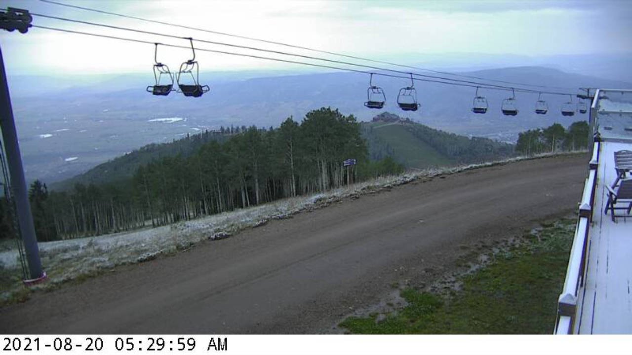
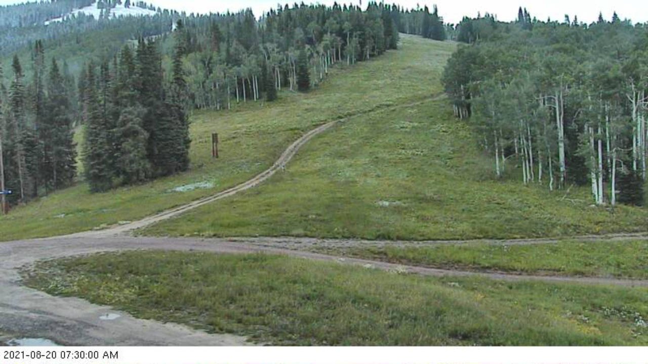 Just a quick update to yesterday’s weather narrative to mention that as of this morning, 20 August, the Steamboat Ski Resort has received its first snowfall of the 2021-2022 ski season!
The final push of cold air associated with the storm came through around midnight last night, and dropped temperatures at the Storm Peak Lab near the top of Mt. Werner to 29 F.
Shown in the two pictures from early this morning is snow on the deck of Four Points and the top of Twister and a patch of snow near the top of High Noon taken from the Rendezvous cam.
Also, in addition to the rainfall totals from yesterday morning, areas around town received another three to four tenths of an inch of rain, with 0.44” reported near the top of Steamboat Boulevard.
Steamboat’s two seasons
Friday, May 25, 2018
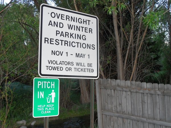 You may think that Steamboat has four seasons, but apparently there are only two - ski season and construction season!
Sometimes, they overlap.
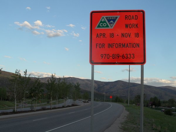 For those traveling to and from our little corner of paradise this summer, CDOT is halting road construction on Rabbit Ears Pass during our busiest times. Check out their latest updates here.
SnowAlarm also has some live CDOT cams archived and available to loop, if you want to see what you are getting into. Check those out here.
Some skiing before and after Closing Day
Wednesday, April 25, 2018
The first video was taken by Ski Town broker Dave Moloney on the Monday before Closing Day. The morning ski report from the Steamboat Ski area had 5.5” of new snow at mid-mountain and 8” up top; between 5am and 9am, some Steamboat Magic produced an additional 6” of snow up top! After an outstanding run down No Names mid-morning, we hiked to Middle Rib from Last Chance since the Pony Express lift had closed for the season. These aspen just off the trail bekon to me all summer when riding up the Pioneer mountain bike trail.
The second video and some associated pictures (click the arrows on the right and left hand side of the pictures that appear when hovering - the video is the last one), also taken by Ski Town broker Dave Moloney, was on the Sunday after Closing Day. Quite the warm day, with temperatures reaching 70F in the Yampa Valley, but the corn skiing on the hill was excellent. We hiked up to the top of the Thunderhead lift via Vagabond and skied Rudi’s Run.
Chasing Totality
Tuesday, August 22, 2017
I am still completely and utterly blown away. An emotional and visceral experience that was unimaginable, even after reading and watching videos and posts describing past total solar eclipses. An event so profound, awe-inspiring, spiritual, immersive and overwhelming that it left me shaking with excitement for a half hour after it ended with tears in my eyes. Even today, waves of emotion wash over me as I try to describe what I saw. The now obvious and undeniable fact is you must be there to witness totality. Only then will the event be seared into your consciousness for eternity.

A friend and I left Steamboat Springs around 5 am, 21 August 2017 and headed for an area south of Casper, Wyoming. The early morning clouds did dissipate as forecast, though they highlighted a spectacular sunrise driving north from Walden towards Centennial, Wyoming.
 The view looking south from our remote eclipse viewing area when we first arrived, about 30 miles south of Casper, Wyoming.
 A view of our observation deck. Very low-tech, though there was a telescope with a solar filter behind us. The couple there were kind enough to let us view the partial eclipse phase both before and after totality. We could literally see the moon moving past the sunspots at around 50% coverage, as well as some solar prominences.
 A view to the north shows Ice Cave Mountain just south of Casper, with its stunning white cliffs, and the lunar-looking intervening landscape.
As totality approached, the sun, as viewed through the eclipse glasses donated by a gracious friend the night before, became a thin crescent that steadily grew smaller and fainter until only an amoeba-looking remnant winked out of view. The valley winds suddenly died, the temperature dropped, and an eerie quietness enveloped the prairie as I removed the glasses to see a still-dazzlingly bright sun. At that point, the phenomena associated with totality began.
Frankly, I forgot about the camera for the first half of totality as I was overwhelmed by the spectacle, but managed to take the following three pictures during the few seconds around the end of totality. You can see the star Regulus, Leo the Lion’s brightest star, shining through the corona in the southeast quadrant of the first picture. At this point, the Shadow Bands, also present for a short time as the eclipse first dipped into totality, reappeared and danced across the landscape, even as a 360 degree sunset/sunrise surrounded us. These diffuse and eerie bands of light are caused by the few remaining rays of sunlight diffracting around the moon, and are mixed in with the impossibly sharp shadows present around totality.

Now we are just a split second past totality when a brilliant flash of white light, termed the Diamond Ring, briefly appears. This is also present just before totality, when the last ray of sunlight slides around the moon, and seeing it flash felt like a hammer-blow to the head; a sledgehammer to the soul. I mean, I expected to see something, as the effect is well discussed, but I was not expecting an infinitely bright and compact flash of dazzlingly pure white light that was immediately followed by the deep blackness of the moon covering the sun at the start of totality. An instantaneous change between blindingly pure white and infinitely deep black that took my breath away. Not that I was looking, especially as a scientist, but as totality ended, I could not imagine a more literal interpretation of Let there be light.

The Diamond Ring below is still in the process of expanding, even though the flash of light appears vanishingly brief.

 We just sat there for a half hour, in befuddled amazement, trying to make sense of what we had just witnessed, while reveling in the final phases of the eclipse. Finally, we grudgingly left our observation deck and, looking to escape the traffic, took the gravel road less traveled by. The Bighorn Mountain Range frames the serpentine escape route with this northeast view.
 Some nice granite outcrops while we were avoiding traffic on the 60 mile loop of gravel roads.
 Back in time for sunset in beautiful Steamboat Springs.


