
More fall photos - part 2 of 3
Sunday, November 2, 2014
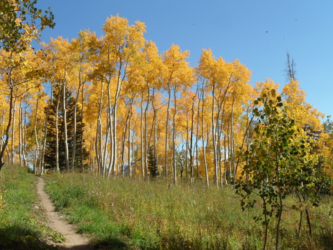
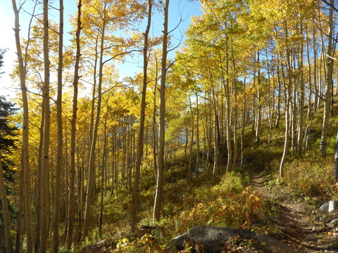
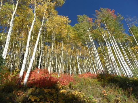
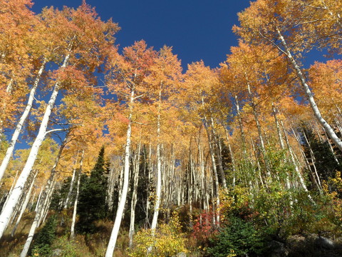
Some more photos of the spectacular color this fall! This sequence is taken over a week or so and shows the mountain as I rode from the bottom to near the top.
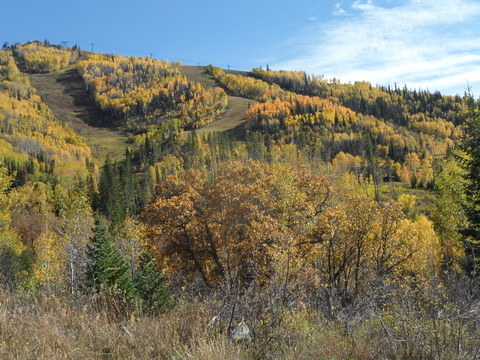 A nice panorama of the lower mountain taken from just uphill of the Thunderhead maintenance building at the bottom of Tenderfoot, taken 8 Oct 2014
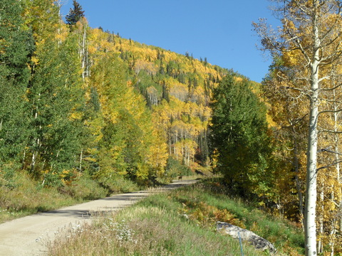
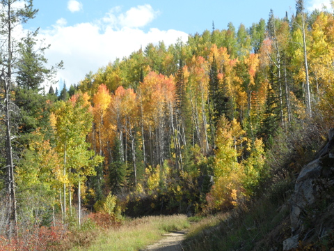 Higher up on the hill is a view of the Zigzag trail as it skirts the northern side of the Steamboat Ski area near Burgess Creek, taken 26 Sep 2014
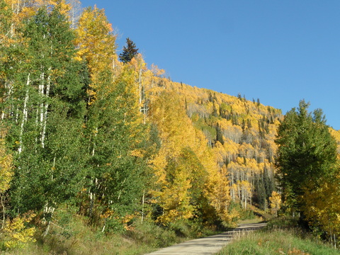
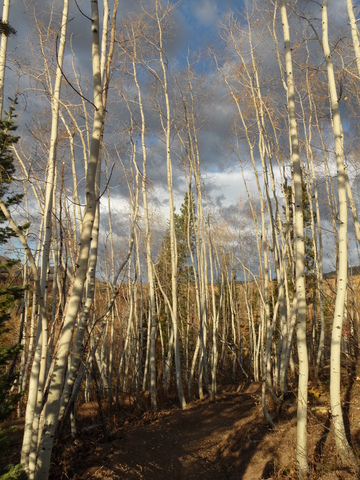
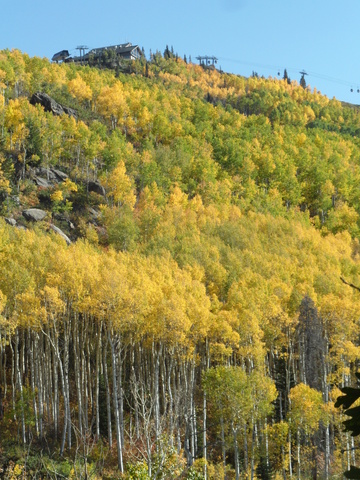 Looking up at Thunderhead Peak from Tenderfoot just below Vagabond saddle, taken 25 Sep 2014
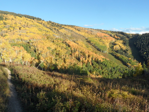 A panorama of the Priest Creek area of the upper mountain taken from the Elkhead trail on 25 Sep 2014. Note the Duster cat track cutting across the Closet, Shadows, Three O’Clock and Two O’Clock in the upper third of the photo.
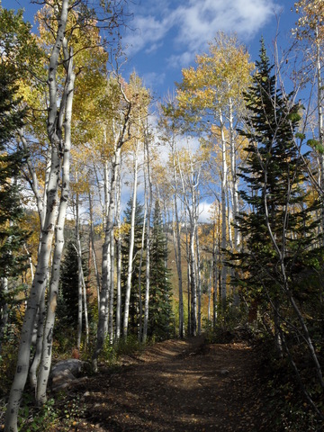
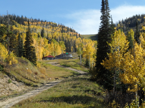
 Looking up the bottom part of Sunshine just above Rendezvous Lodge, taken 20 Sep 2014
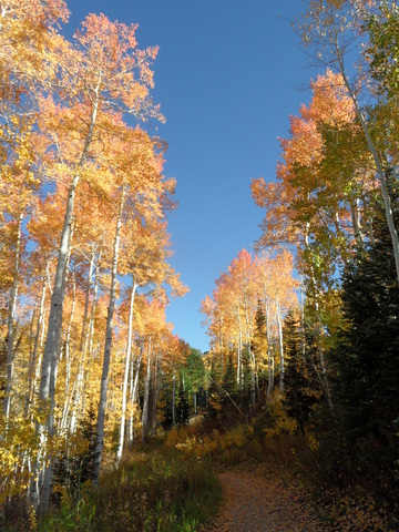
 The upper part of Sunshine taken just after the apex of the trail near the top of Two O’Clock on 25 Sep 2014.
More fall photos - part 1 of 3
Saturday, November 1, 2014
Some more photos of the spectacular color this fall highlighting the changes in color and coverage that occured in only a few days time.
The photos above were taken from Duster looking up into Twilight on 18 Sep 2014 and 25 Sept 2014. Notice the nice red color of the changing aspen.
The photos above were taken on Duster from Rainbow saddle on 20 Sep 2014 and 25 Sep 2014. Notice the deer standing in the middle of the trail on the first photo!
The photos above were taken on Tenderfoot on 29 Sept 2014, 5 Oct 2014 and 11 Oct 2014 as the remaining leaves fell from the aspen.
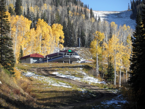
The photos above were taken near the base of the Pony Express lift looking up at the Storm Peak lift on 8 Oct 2014 and then 14 Oct 2014 after our first substantial upper mountain snow. Another deer managed to pose for the first photo!
Another weeks end storm
Thursday, October 30, 2014
A ridge of high pressure will keep our beautiful weather around until a strong Pacific storm currently bringing precipitation to the northwest affects our weather starting this weekend. Even California looks to receive significant precipitation as the storm makes landfall there late Friday night.
Southwesterly flow ahead of the storm will bring increasing moisture into our area on Saturday, though temperatures will be warm with high clouds. As the storm approaches the Great Basin on Saturday it is expected to split, making the forecast for Sunday through Tuesday a bit uncertain.
Current forecasts have a lead shortwave moving over our area early Sunday with some precipitation expected, though it will likely be light and relatively warm, with high snow levels. Cool air will filter in through the day Sunday, but most of the storm will be felt as the southern portion of the storm approaches our area later that day or evening.
The American GFS keeps this southern energy over our area during the day Monday, leading to snow and sharply colder temperatures as northwest flow is established behind the front. Snow may be moderate to heavy at times Monday, even in town, before ending that night. The European ECMWF, on the other hand, is forecasting more energy left behind in the Great Basin, and in fact closes off the storm and forms a cutoff low that moves over the U.S. - Mexico border later in the week. This solution would lead to warmer weather and less precipitation as energy passes south of us, though the unsettled conditions would be with us longer, likely through Tuesday.
In either case, a flat ridge is forecast behind the storm, leading to warmer temperatures by mid-week and lasting through at least the rest of the workweek. A storm from the Gulf of Alaska is currently forecast to stay north of us for the following weekend, though that forecast is uncertain at this time.
Beautiful weather interrupted near weeks end
Thursday, October 23, 2014
Spectacular fall weather will continue through most of the weekend before a storm affects us sometime on Sunday and Monday. There is uncertainty as to whether precipitation starts early or late in the day Sunday, but the heaviest precipitation should occur through the overnight hours and early in the morning Monday as the cold air associated with the storm sweeps through the area and lowers snow levels. Most of the accumulating snow should be confined to above 9000 feet, but we may see snowflakes in town as well.
Showers will persist through the day Monday in cool and unstable northwest flow behind the departing storm. Tuesday should be pleasant after a cold morning start before there is again disagreement between the models for midweek. The American GFS model is predicting a fast-moving wave from the Pacific interacting with a wave traveling southward from the Canadian Plains and producing some precipitation late Wednesday into Thursday. The European ECMWF, on the other hand, rebuilds a ridge over the inter-mountain west, leading to dry weather. Both models, however, show some of the cool air from the north filtering over our region late in the workweek and possibly into Saturday.
Both models also have that ridge strengthening by mid-next weekend and dominating our weather into the following week, leading to more warm and dry weather.
Pleasant fall weather through early next week
Thursday, October 16, 2014
Beautiful fall weather will continue through early next week. A small circulation currently off the northern Baja coast will pass over southern Colorado tomorrow, perhaps bringing some high cloudiness into our area for Friday.
Then, early in the weekend, a Pacific storm crosses the California coast and strongly splits, with the southern portion drawing some moisture from the southwest over our area by Sunday. Southern Colorado may see some showers, but we should remain dry.
A stronger storm is forecast to cross the California coast early in the workweek and again strongly splits. This storm is currently forecast to be strong enough so that the northern branch will bring a cool front through our area sometime on Wednesday, and this cool air should phase with a surge of moisture brought over our area from the southern branch.
Current longer term models have beautiful fall weather returning soon after the system departs by Thursday and possibly lasting through most of the rest of October.


