
Mountain biking on Sunday and powder skiing the next Saturday!
Sunday, November 16, 2014
Last mountain bike ride of the season on Sunday 8 November 2014
First powder turns of the season the very next Saturday 15 November 2014!
Snow ends tonight followed by sunny and cold conditions
Saturday, November 15, 2014
The storm forecast for today is winding down and is expected to end by midnight, with 8” of snow showing on the Steamboat Powder cam as of 5:30 pm this afternoon and possibly another inch or two added for the morning observation. Cold temperatures will follow in the wake of the storm, falling from the current 2 F up top and 15 F in the valley.
There may be some clouds the next 2 days as waves of energy skirt to our northeast around a very cold mid-west trough, but we should see increasingly sunny skies headed into midweek. Warmer temperatures will return by Tuesday afternoon ahead of a Pacific disturbance undercutting the west coast ridge. This is the storm originally forecast to bring significant weather to our area, but now the storm is forecast to be considerably warmer, weaker and slower. Furthermore, there is model uncertainty with respect to the strength and timing of this wave.
Models indicate some sort of storm for next weekend after a transient and shallow late-week ridge moves over the area, but the details of that forecast are in doubt considering the midweek uncertainty.
Winter is here!
Tuesday, November 11, 2014
The forecast from last week underestimated the amount of snow received Monday from the well-advertised cold front that moved through the area that morning, with 4” on my deck by noon that day. Currently, very cold air is lurking to to our north and east, and some more of it will be dragged over our area early tomorrow morning as a wave rotates over our area from the north. Light snow is expected on the hill, and while we may see some snowflakes in the valley, current forecasts call for no further accumulations.
That changes in a big way on Thursday as a Pacific wave undercuts the strong ridge in the Gulf of Alaska and brings some upward motion and moisture in northwest flow over the current dome of cold air. Temperatures may warm a bit with a mix of rain and snow in the valley by Thursday afternoon, but significant snowfall is expected on the hill through Thursday night. If the mountain was open, I would expect 4-8” of snow on the morning report.
Continued moist northwest flow will keep the weather unsettled for Friday, though we will see more warming behind the Thursday storm. This warming will stabilize the atmosphere and likely keep the valley mostly dry with a possible rain/snow mix if showers do occur, while minimizing snowfall on the hill.
But another cold wave rotating around the cold air to our north will push another cold front through the area on Saturday. Because we are forecast to still have moist northwest flow in the mid and upper levels of the atmosphere, I expect another round of significant accumulations, with moderate to heavy snowfall up on the hill and likely in the valley as well by Saturday afternoon and lasting through Saturday night. I anticipate another 6-12” by Sunday morning if the Steamboat Ski Area was reporting.
There may be a brief break sometime on Sunday before snow is forecast to begin again by later in the day and continue overnight as waves in moist northwest flow pass over the area. Another brief break on Monday before a much stronger Pacific wave is forecast to cross the west coast and travel over our area around Tuesday. Again, the models are forecasting moderate to heavy snowfall with this wave that looks to last through at least Wednesday.
Not that we should be surprised, but it’s always amazing when the last mountain bike ride of the season on Sunday of last weekend is followed by powder skiing the next weekend!
Cool and mostly dry next week
Thursday, November 6, 2014
A mostly dry and cool forecast will dominate this next weeks weather after a beautiful weekend, except for around Monday when some light snow and a blast of seasonably cool air is forecast for our area.
Current sunny conditions will mostly last through the weekend. A weak wave skirting our northern border will drop temperatures a bit tomorrow and possibly bring some clouds before they warm again by Saturday.
Another wave crossing the northwest coast from the Pacific on late Saturday night will phase with some cold air moving southward from the Canadian Plains and force a cold front through the area on Monday. There will be some snow associated with this front as the remaining Pacific moisture is lifted over the Park Range, but most of the weather will be confined to the Front Range. Several more waves moving southward from the Canadian Plains will keep the seasonably cold air in place most if not all of the workweek, with some very light snow possible for a short time around late Wednesday.
There is uncertainty late in the workweek, and heading into next weekend, regarding whether the cold air moves eastward or is reinforced, as the American GFS has warmer weather returning by then while the European ECMWF keeps us cooler.
More fall photos - part 3 of 3
Sunday, November 2, 2014
Last in a series of posts showing some of the spectacular color this fall!
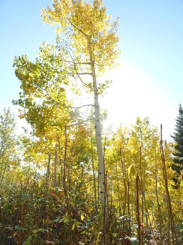
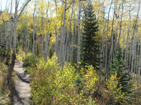 Looking up Tenderfoot near the bottom of this trail just above the intersection with Zigzag on 4 Oct 2014
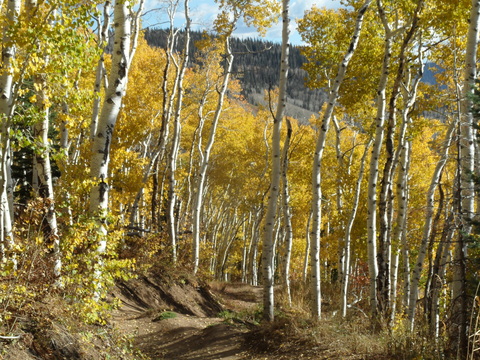
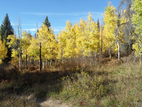 Taken near the top of Creekside on 7 Oct 2014
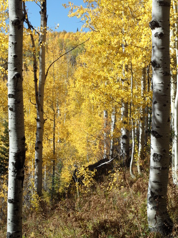
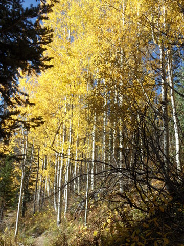
Another pair of photos looking down Creekside from a bit lower down on the the trail, taken the next day on 8 Oct 2014.
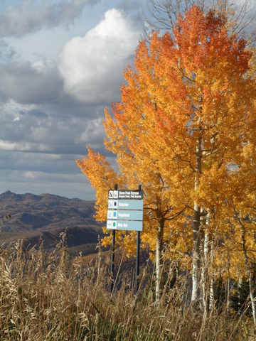
The photo on the left is taken on Tenderfoot on 5 Oct 2014. The photo on the right is taken on the Why Not road running by Surprise and looking north toward Rocky Peak (the peak seen on the left center edge of the photo) on 19 Oct 2014
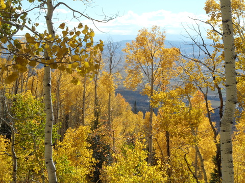
 The aspen color was holding strong on the upper reaches of Rustlers Ridge just below Thunderhead Peak as late as 19 Oct 2014.
 Another colorful photo taken from lower down on Rustlers Ridge looking out over the Yampa south valley on 19 Oct 2014. The Flat Tops can be seen through the haze on the horizon.


