
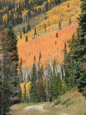
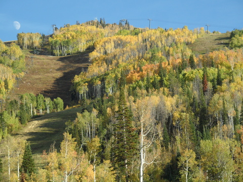
Some more fall pictures from the last week
Sunday, October 5, 2014
I’ve fallen a little behind in posting some of the pictures I’ve taken in the last few weeks, and following are some of them taken in the last week.
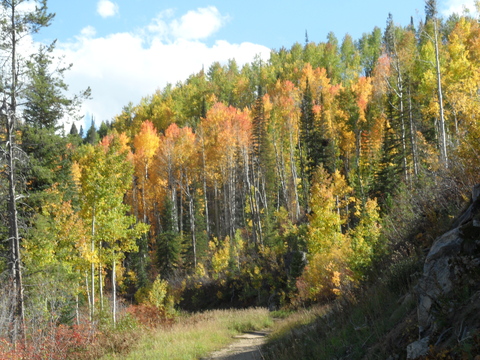
Here’s one heading up ZigZag last weekend just before the Creekside trail.
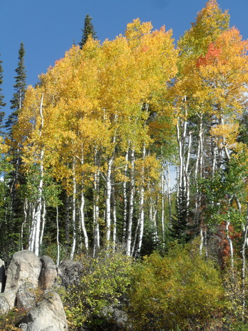
The aspen grove just uphill from the base of Pony Express lift.
Sun-splashed aspen at the base of Pony Express
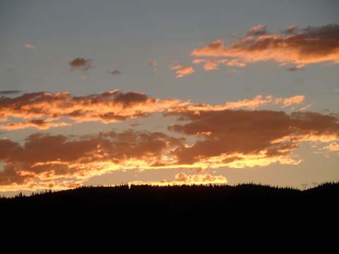
Another nice sunset from my deck.
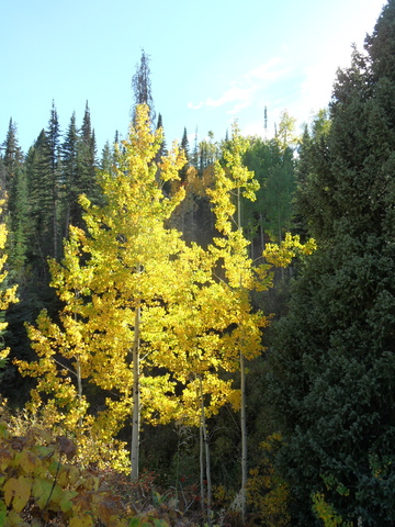
Looking towards Twilight trees from Rendezvous saddle with Duster in the foreground.
Moonrise over the lower mountain, taken from just above the base of Thunderhead lift.
Dry and seasonable weather for the next week
Thursday, October 2, 2014
The storm that brought the season’s first snowfall to the Steamboat ski area and snowflakes to town has moved east of the area leaving cool temperatures and some clouds in its wake. A trailing wave will graze our area late tonight into early tomorrow morning, reinforcing our cool temperatures and keeping some clouds around early in the morning.
Temperatures should rebound into and through the weekend, especially at higher elevations. The warmup will be tempered, however, as the storm that just passed deepens and becomes a strong closed low just north of the upper Midwest border with Canada. This will bring unseasonably cold temperatures to the Great Plains and will leave us susceptible to cool air surges on Sunday and Monday as waves of energy rotate around this feature.
Dry and pleasant weather should persist through the rest of the workweek as a flat ridge builds in the Gulf of Alaska. However, waves of energy from the Pacific rounding this ridge are forecast to eventually break the ridge down, allowing cool air and precipitation to move over our area from the north. Timing is uncertain this far in advance, but current model forecasts bring a change to more stormy weather sometime next weekend.
Steamboat ski area receives first snow
Tuesday, September 30, 2014
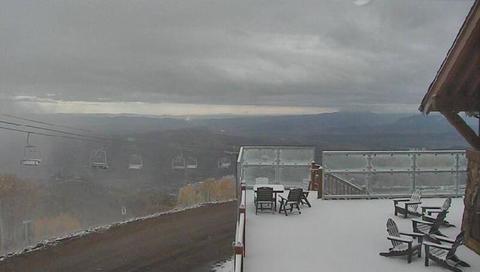 First snowfall for the Steamboat ski area arrived yesterday afternoon as the upper low advertised in last Thursdays forecast moved over our area about 12 hours slower than I thought. This picture was taken around 8:15 am Tuesday morning 30 September 2014 and is from the Four Points Lodge Mountain Cam. Unsettled weather will continue today and tomorrow with the last and coldest part of the storm pushing through tomorrow afternoon, bringing accumulating snow to the mountain tomorrow afternoon and likely snowflakes to the valley floor by Wednesday night.
Big storm ends weekend and lasts through most of the workweek
Thursday, September 25, 2014
The storm advertised last week will begin affecting our weather by Saturday afternoon as it moves from its current location in the Gulf of Alaska southeastward towards the Great Basin over the weekend. Moisture drawn from the southwest ahead of the storm will move over our area during the day Saturday and will create the threat of some wetting rains, especially in the afternoon and evening.
The low is forecast to become cutoff from the main westerlies by mid-weekend, and waves rotating around this cutoff will eventually bring moderate to heavy rain to our area during the day Sunday. There may be breaks in the precipitation, but rain will continue for most of Monday as the upper cutoff low approaches and eventually moves over us by Monday night. As that happens, the cool flow will turn to the Steamboat’s favored northwest location and keep the chance of rain showers for the valleys and possible snow showers for the higher elevations going through Tuesday until early Wednesday morning.
There is considerable inter-model and intra-model uncertainty with the eastward speed of the cutoff low that may slow its eastward progression by a half day or so. Additionally, there are another two waves upstream, with the first bringing a reinforcing surge of cool air by Wednesday.
The second storm looks to be quite strong as it travels southeastward from the Pacific northwest by Friday. The southwest flow ahead of that storm looks to bring some brief warming and drying ahead of the storm by late in the workweek, but some models have it finally moving over our area sometime next weekend. This storm is currently advertised to bring a stronger push of cold air over our region and may threaten snow near the valley bottom.
Spectacular sunset instead of rain
Saturday, September 20, 2014

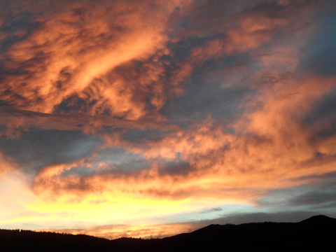 The first part of the storm forecast for this weekend was weaker and drier than expected, bringing some scattered clouds into our area late in the afternon. Rather than rain, a spectacular sunset graced Steamboat Springs last night.
Both of these were taken looking west towards Emerald Mountain from my deck Friday evening.
I still expect the second part of the storm, which is currently a cutoff low just off the coast of south-central California, to move westward during the day tomorrow, bringing first showers earlier in the day and then moderate to heavy rains by the late afternoon or early evening. Rain and rain showers will continue during the day Monday, until the upper low moves east of our area by early Tuesday, bringing warming and drying to the area.


