
Good skiing today, but better skiing tomorrow
Thursday, March 27, 2014
The Steamboat ski area reported 3” mid / 4” top this morning, and it was lightly snowing at report time. There was less than an inch of additional accumulations during the day with some sun on the hill, though it was snowing hard at 4 pm as another convective shower moved through. I currently see more showers upstream on the satellite loop, so we will continue to experience localized and heavy showers through the evening. They will probably wane near midnight, but then pick up again early in the morning as the second part of the storm moves over us, hopefully contributing to some Steamboat Magic between 5 am and 9 am tomorrow morning.
Interestingly, Steamboat recorded one of the lower snow totals this morning in Colorado; the storm produced localized areas of heavier snow last night, and we were unlucky enough to missed by some of these convective cells. Hopefully, we do better tonight!
There was some wind last night, and that evenly compacted the snow in most locations on the upper mountain, creating a smooth and carveable surface. The compacted snow had a fair bit of substance and it skied pleasantly soft on the upper half of the upper mountain. Though the snow became significantly heavier in the lower half, the old snow / new snow interface was not frozen, so it was still soft, albeit crunchy.
The snow was a bit deeper at the top of Morningside - probably around 6”. Christmas Tree Gully was fairly chewed by the time I got to it, though there was good skiing along the sides of the alleys through the trees. No Names skied quite good, especially when turning in the untracked powder.
Excellent snow quality today
Sunday, March 23, 2014
The Steamboat ski area reported 5” mid / 6” top this morning, though, as expected, all of that came during the day on Saturday. In fact, I measured 4” of snow on my deck that fell between 6 am and 10 am Saturday morning. The snow started slightly earlier on the hill and lasted longer, though the sun was out late in the day.
I had expected that snow quality would have been similar to last Tuesday or the Tuesday before that, but that was not the case. The temperature this time did not get colder than about 13 F up top during the snowfall while the previous two storms were in the mid single digits. The end result is the snow skied a fair bit heavier yesterday, even on the northern-tilted aspects.
I had lowered snow-quality expectations for the sunny day today, but was pleasantly surprised to find that the lower relative humidities and breezy conditions last night and today dried the snow a fair bit. The snow was far more workable, at least for the upper half of the upper mountain. Closet skied great, as did the Rolex trees, Kuus’ Cruise and Typhoon. The last run of my day was spent poking around in No Names, still uncovering batches of untracked turns in the deep powder.
The grazing wave expected for tomorrow looks to bring some cooling, but precipitation will stay almost completely to our east and north. Sunny weather is on tap later in the day, Tuesday and likely Wednesday morning before the next significant storm begins to affect our weather later Wednesday. Current forecasts show a couple of waves keeping snow going on the hill from late Wednesday to late Friday. There may be some rain in the valleys preceding each frontal passage before that turns to snow.
Another round of Tuesday powder makes for great skiing
Tuesday, March 18, 2014
The Steamboat ski area reported 3” mid / 5” top at 5 am this morning, and by 1 pm the report had 7” mid / 10” top. Interestingly, there was 3” up top at 4 am and it snowed about an 1” / hr between 4 am and 9 am, except for a 2.5” burst between 4 am and 5 am - now THAT is Steamboat Magic!
More magic was in force on the other side of the Sunshine Peak ridge as over 16” of snow was measured in the early afternoon near the base of the Morningside lift! Satellite loops showed a persistent convective cell in the area from about 7 am to 2 pm that was likely the cause of the enhanced snowfall rates. And I measured as much of 20” in the Second Pitch!
Similar to last Tuesday, the skiing kept getting better as the snow accumulated and covered the last run’s tracks. The upper half of the upper mountain skied great all day, while the lower half benefited greatly from the additional snowfall during the day.
The first time I was in Shadows, for example, the lower parts were still crunchy, so I went over to the Twilight trees seeking a flatter pitch so as to keep above the hard surface. The skiing here was soft through the whole run, as expected. In fact, I did about four runs in a row as I kept finding untracked lines, and even the pitch below Duster skied great.
It seemed there was less snow over in the Rolex trees, but the Sundown and Priest Creek liflines skied soft and effortlessly. The 3:30 trees still had big swaths of uncut powder when I finally left that to check out what the additional snow had done for Shadows. By then, I was measuring almost a foot in the favored locations, and the skiing turned great for the entire run as the crunchies were well buried.
After several more runs in Closet and Shadows, I jumped into Morningside and was greeted by the 16”. It was a bit shocking to see that much snow back there, and I had enough time to lap Wake Up Call three times off the top - with face shots on the initial steep pitch. After that, one more hike to the top to ski the East Face, and then over to the Second Pitch to sample the 20”.
It’s always nice to be reminded of mid-winter skiing in the springtime, especially when the snow quality is fantastic!
Great skiing yesterday
Wednesday, March 12, 2014
The Steamboat ski area reported 3” mid / 1” top Tuesday morning, and the report for this Wednesday morning was 4” mid / 8” top, with almost all of the reported snow today occurring during the day yesterday.
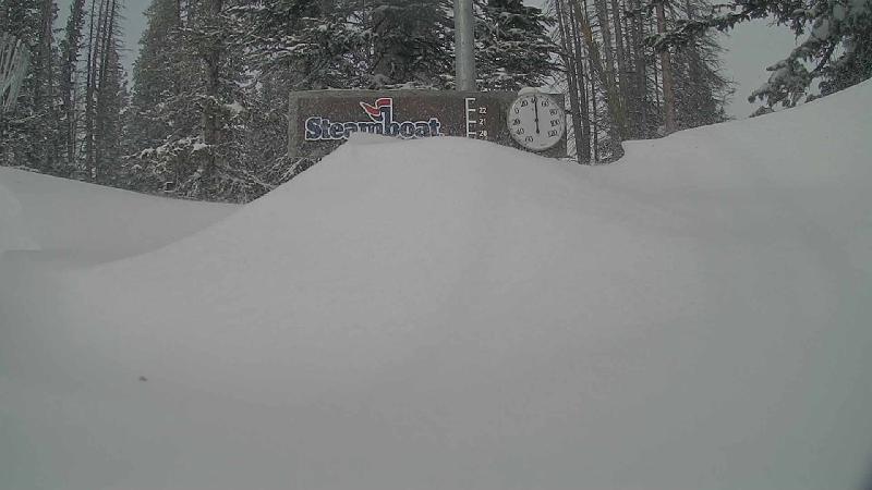
I’d like to point out an inconsistency in the morning report; the 5am report is apparently composed of a measurement around 4:30 am at mid-mountain, while the top measurement is called in by a snow cat driver closer to 3 am, at least based upon the report yesterday morning and the pictures provided by the powdercam located next to the measurement stake.
The end result is that disparities between the 5 am mid and top measurements should be discounted since the top measurement is not taken at the standard time. Indeed, the top did NOT receive 5” of snow between 5 am and 9 am yesterday morning as reported; it received 5” between 3 am and 9 am, and 3” between 5 am and 9 am, similar to what mid-mountain received.
So I headed up yesterday mid-morning for the 6” of snow, and several snow showers during the morning and early afternoon kept the runs skiing fresh as we eventually netted 8” mid / 9” top. Closet into Shadows first thing was generally very good until the crunchy sub-surface was exposed about half way down. Skiing was better and more consistent in the more northern aspects of Closet and Sideburn.
Twilight and both skier’s right and left of that drainage skied great as the pitch was shallow enough and the still-accumulating snows deep enough to separate the skier from crunchies underneath. Same for Rolex, and generally the top half skied better than the bottom half all day.
I had planned for only a couple of hours of skiing, but the conditions kept improving during the day. North St. Pats skied great, as usual, though by then easterly winds had picked up creating a smooth surface of wind-packed snow. As the winds increased for my last run, No Names provided great shelter and snow.
Those easterly winds played havoc with the snow measurement site - check out the drifting at about 3:45 pm yesterday; the location was buried 15 minutes later!
Skiing quite good, despite the wind
Saturday, February 22, 2014
The winds were picking up when I headed up around 2pm today, but they were less than the last couple of days, at least initially. Shadows was in surprisingly excellent condition as there was soft snow throughout. Perhaps the winds were strong enough to move the snow around but not strong enough to scour it from the surface. I did note some graupel this morning, and that may have played a part in the good skiing as it tends to roll into the existing ski tracks and smooth the surface.
I tried out skier’s left of Twilight, and found that far more inconsistent than Shadows. The same was true for the Rolex trees, so I skied another lap in Shadows to finish the day. I had hoped to visit the Chutes area as that has been excellent as well these last few days, but did not leave enough time for that.
We have more snow tonight, but unfortunately more wind as well. Let’s hope tomorrow is more like today than two days ago.


