Nice workweek to follow a last round of showers today
Sunday, October 25, 2026






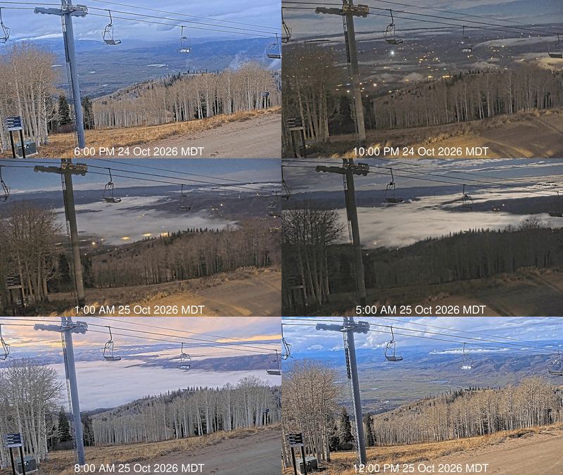
After a night of moonlit fog in Steamboat Springs, captured below as a time-lapse from 6 pm Saturday to noon today, a couple of hours of late-morning sun is yielding to cloudy skies ahead of another round of afternoon and evening showers. But the sun returns by Monday afternoon, with warming temperatures and mostly clear skies persisting for most of the workweek. A more substantial storm is forecast for around next weekend, or shortly after.
 An eddy left over from the previous storm is moving toward Colorado from Arizona. Increasing clouds will precede the start of showers later this afternoon as energy from the approaching eddy rotates northward around the frontside of the eddy.
Snow levels are now just above mountaintop, and fall to around 8,500′ by Monday morning, so showers starting later this afternoon may lead to minor snowfall accumulations at higher elevations as the eddy moves overhead.
Skies should be clearing Monday morning, with mostly sunny skies by the afternoon and high temperatures in the low 50s, just below our 54-degree average.
Meanwhile, the northern part of a storm that split in the Gulf of Alaska on Friday is over Vancouver, while the southern part has formed an eddy which will weaken and loiter over the east-central Pacific this week. While most of the Vancouver part of the storm is forecast to be pushed eastward on Monday by a quick-moving pulse of cold air from Siberia, the central Pacific eddy may be a player in our next storm as the Siberian wave settles over Vancouver by midweek before elongating southward along the West Coast by the end of the workweek.
By Tuesday, the Vancouver eddy will have crossed Idaho and moved into Montana, staying north of our area and bringing a breezy Tuesday afternoon. A ridge of high pressure begins building over the Great Plains behind the storm, keeping mostly sunny skies overhead and allowing high temperatures to rise from the mid-50s on Tuesday toward 60 degrees on Wednesday, staying above average for the rest of the workweek.
While the workweek will be nice, it’s too early to speculate on Halloween’s weather, as that will depend upon the developing late-week storm along the West Coast and how it interacts with the decaying central Pacific eddy. I’ll have more details about that in my next regularly scheduled weather narrative on Thursday afternoon.