Cold and wet weather for the first day of summer
Thursday, June 20, 2019
Enjoy the sunny and warm weather we are currently experiencing early this Thursday afternoon in Steamboat Springs since a cold front is barreling down from Wyoming. A rude welcome to the summer season is on tap for tomorrow, the first day of summer, when the Summer Solstice occurs Friday at 9:54 am MDT. Much colder temperatures along with rain in the Yampa Valley and snow at the higher elevations will occur tomorrow and through the weekend before more summery weather returns for the beginning of the workweek.
The inclement weather is courtesy of an unseasonably cold storm currently in Idaho that will move across Montana on Friday and head north into the Canadian Plains on Saturday. A couple of waves of energy and moisture spinning around the storm will drag two cold fronts through our region, with the first one timed for later this afternoon and the second for later Saturday.
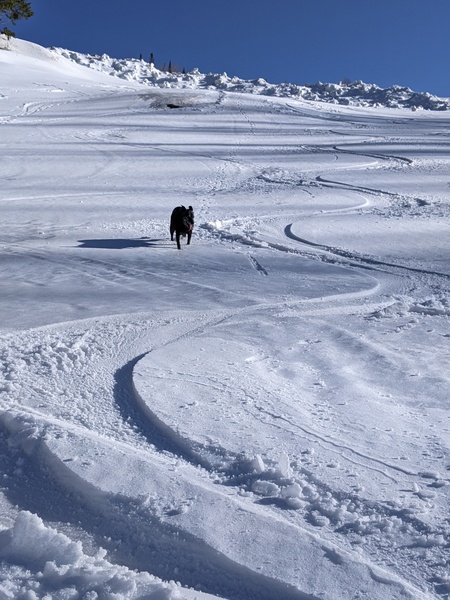
Winds have already increased ahead of the first cold front, with showers expected ahead, along and behind the front. As the storm to our north moves slowly eastward, the cold front stalls over northern Colorado for a couple of days, becoming a stationary front and bringing steadier rain overnight and through tomorrow, with several inches of accumulating snow expected above 10,000′, snowflakes down to 9000′ and high temperatures twenty to thirty degrees below our average of 75 F! Follow any snowfall on the Powdercam at the top of Sunshine Peak or at the Four Points cam.
Another lobe of energy rounds the storm during the day Saturday and drags a second cold front through our region Saturday afternoon or evening. Precipitation may become lighter and more showery, with peaks of sun, early in the day as the southwesterly flow ahead of the secondary cold front pushes the stationary front northward, but showers will increase again ahead, along and behind the second cold front. Localized moderate to heavy precipitation, even lower snow levels, gusty winds and small hail may make travel difficult, especially at pass level, during the afternoon and evening.
Precipitation will likely end for a time later Saturday night into Sunday morning as the storm moves east of our area, but showers will redevelop during the day Sunday and extend into the evening in the cold, moist and unstable northwest flow behind the front.
Winds will turn to the west on Monday and then southwest as another strong Gulf of Alaska storm moves toward the Pacific Northwest early in the workweek. While this storm will also be unseasonably cold, summer looks to win this battle and keep the storm away from our area as a ridge of high pressure builds over the west. Very dry air and temperatures recovering to near average on Monday and then eventually above average are forecast for the remainder of the workweek and heading into the following weekend.
Even as the springlike storm passes by this weekend, there are signs of the North American Monsoon starting as moisture from Mexico is pulled northward around the building ridge of high pressure over most of the U.S. At this point, the moisture is not expected to make it further north than central New Mexico during the week, but it’s interesting and unusual that I am discussing air masses from near the North Pole and the Equator in the same weather narrative.
Add comment
Fill out the form below to add your own comments


