Pacific ridging limits snow chances this week
Sunday, January 28, 2018
Ridges of high pressure are currently located over the Bering Sea and the West Coast. Pacific storms are located upstream and downstream of the Bering Sea ridge, with the downstream storm moving from its current position in the Gulf of Alaska to the Steamboat Springs area by midweek.
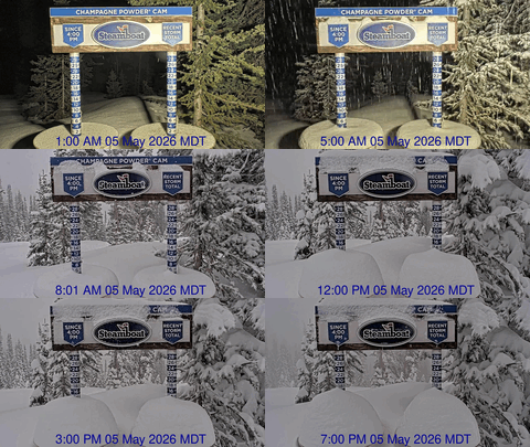
Before we move on to the forecast, I’d like to point out that the while the past Friday storm total showed 8” at mid-mountain and 9” up top in the 48 hours preceding the Saturday morning report, the Steamboat Powdercam showed 15” at 8:40 am Friday, which means that 10” of snow fell between 4:40 am and 8:40 am Friday morning on top of the 5” reported that morning. There was also significant settlement of the snow pack; I estimate the snow was compacting at around a half inch per hour, which means snowfall rates were approaching 3”/hour for 4 hours! This Steamboat Magic was due to cold temperatures around 5F (which resulted in light and airy very low density snowflakes), moist northwest flow (which resulted in efficient orographics, or terrain-lifted precipitation, where higher precipitation totals are usually found at higher elevations - I measured two feet up at the top of Mt. Werner, a short hike up from the Morningside lift and 180 feet higher than the Powdercam), a cooling atmosphere, which lead to atmospheric instability, and favorable upward motion associated with the storm.
All of these ingredients came together for a magical snow day Friday.
Back to the forecast, the Gulf of Alaska storm is now moving eastward, and this pushes the West Coast ridge over our area by Tuesday. Any lingering snow showers will end today, and expect warming temperatures and clearing skies for Monday and especially Tuesday.
By Wednesday and Thursday, the Gulf of Alaska storm grazes our area as another ridge pops up off the West Coast in response to Pacific energy further upstream undercutting the Bering Sea ridge. This is unfortunate as it is similar to the pattern that occurred earlier in the winter that kept the cold air and storm track over the eastern two thirds of the country.
The end result is a once promising midweek storm is pushed to our north and east, grazing our area and limiting precipitation to only some light snow showers on Wednesday and possibly Thursday.
Some Pacific energy may travel over the ridge of high pressure off the West Coast and mix with some cold western Canadian air by around the weekend for a chance of stormy weather, though that storm is trending weaker in the weather models as the West Coast ridge trends stronger.
My new favorite cold-weather glove are all about warmth. And when combined with the standard HotHands handwamers which I use below about 5F, I’m good for the day. Three fingers sit together with the index finger separated, but there is enough room to scrunch all your fingers together while on the lift, which is especially nice if you have a handwarmer in the mitten-part of the glove.


