

Weekend to start nice and turn stormy

Thursday, October 31, 2024
Temperatures are only in the mid-forties under mostly sunny skies this Thursday mid-afternoon, but that is an improvement over yesterday’s mid-thirties! Mostly sunny skies with warming temperatures will start the weekend, but another wintry storm arriving Sunday brings more snow to all elevations.
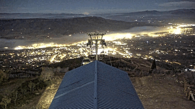
By last Tuesday morning, two inches of snow fell at the mid-mountain Powdercam and five inches at the upper-mountain Powdercam until more dry air than forecast made it into our area and shut off the precipitation during the day. But the snows started again Tuesday night and continued through the afternoon Wednesday, with three inches on my deck near the base of the Steamboat Ski Resort, another four inches at mid-mountain and two inches up top.
The weather has cleared behind the storm, though we may see some clouds as sunset approaches thanks to a weak weather system moving across Wyoming.
Meanwhile, a wave moving across the Bering Sea is forecast to interact with a storm over Vancouver now bringing precipitation to the Pacific Northwest and become our next weather-maker. Mostly sunny skies will start the weekend with high temperatures warming a few degrees into the upper-forties on Friday, just below our average of 51 F. Saturday will reach into the mid-fifties before afternoon clouds encroach ahead of our next significant wintry storm starting Sunday.
The Pacific Northwest storm is forecast to elongate along the West Coast on Friday before moving across the Great Basin on Saturday. Weather forecast models have struggled with the southern extent of the storm and whether it would split and form a southern eddy for several days now, and it looks like the American GFS had an overall better forecast than the European ECMWF with a more coherent storm moving across Colorado on Sunday and Monday.
There will likely still be changes in the forecast as a subtle split is emerging in the latest model iterations, which would change the speed of the storm and the distribution of precipitation. But right now, precipitation should get going by noon on Sunday with rain showers and a rain-snow mix in town turning to snow by sunset, and all snow above Christie Peak.
Snowfall looks heaviest Sunday night, with lighter snowfall continuing through the day Monday. High temperatures will only reach the low forties on Sunday and the mid-thirties on Monday. We could see 2-5” in town by the end of the day Monday and 6-12” on the hill, with difficult travel at times over Rabbit Ears Pass.
A short break on Tuesday looks to be followed by another wintry storm starting Wednesday. So enjoy the pleasant start to the weekend, and check back to my next regularly scheduled weather narrative on Sunday afternoon for the latest details on the two wintry storms.
Wintry weather to begin Tuesday
Sunday, October 27, 2024
Though this Sunday morning started sunny, clouds are overspreading the Steamboat Springs area this noon ahead of a wintry storm beginning to affect the West Coast. Today will be the warmest day of the week with high temperatures once again in the mid-sixties before they fall toward sixty degrees on Monday along with breezy winds and a chance for some showers. But our warm and pleasant fall weather will abruptly end by Tuesday as a Pacific storm brings a strong cold front through Colorado. Significant snow at higher elevations and rain turning to snow in town will precede the coldest day of the season so far on Wednesday before the weather clears for the end of the workweek.
A strong Pacific storm currently extends southward along the British Columbia coast to northern California. Moisture from previous Tropical Storm Kristy, now well west of Baja, has been injected into the southwest winds ahead of the storm and is responsible for the invading clouds today. As has been the case the last several days, high temperatures will once again reach the mid-sixties, over ten degrees above our average of 53 F.
Recent weather forecast models have trended toward a chance of showers on Monday morning, though they will have to overcome a dry lower atmosphere so it is unclear whether rain will reach the surface. There may be some periods of sun and high temperatures are still expected to be above average and around sixty degrees.
But that will be the end of our pleasant fall weather, at least temporarily, as the Pacific storm crosses the West Coast Monday and moves into the Great Basin Tuesday. Precipitation should start Monday night, with the snow level starting near the top of the Steamboat Ski Resort and descending to town by Tuesday afternoon, and continue into Wednesday morning. We could see 6-12” of snow on the hill by Wednesday afternoon and 2-5” in town with high temperatures only in the thirties, with difficult travel at times over Rabbit Ears Pass after noon on Tuesday.
If skies clear behind the storm as forecast by Thursday morning, we will see the coldest temperatures of the season so far with lows forecast to be in the mid to lower-teens, almost ten degrees below our average of 22 F. The good news for the annual Halloween Stroll is plenty of sun Thursday with high temperatures warming into the forties. But temperatures will plummet as soon as the sun goes down so dress warmly under those costumes!
Another strong Pacific storm is forecast to cross the Pacific Northwest coast on Halloween, and weather forecast models disagree on whether and how much the storm splits, but there may be more weather coming our way near the end of next weekend or early the following week. Be sure to take advantage of the next two warm days and check back to my next regularly scheduled weather narrative on Thursday afternoon for more details on our next storm.
Another beautiful fall weekend ahead
Thursday, October 24, 2024
Skies have cleared with temperatures around fifty degrees this Thursday afternoon in Steamboat Springs after a quick shower passed through late this morning. After a chilly Friday morning, with a hard freeze likely, temperatures will warm into the mid-fifties on Friday and the mid to upper-sixties for the rest of the weekend and the start of the workweek. Some passing clouds may interrupt the mostly clear skies until Sunday when clouds thicken ahead of another wintry storm timed to begin Tuesday.
After a storm left around an inch of rain and a dusting of snow in town by Monday morning, and almost seven inches at the Steamboat Ski Resort, our nice fall weather returned by Tuesday with high temperatures almost ten degrees above our average of 56 F. A grazing cool front was responsible for the quick shower and breezy winds earlier today, and will keep our high temperatures slightly below average this afternoon.
A building ridge of high pressure behind the grazing front and ahead of another large and powerful storm developing in the Gulf of Alaska will lead to mostly sunny skies and warmer temperatures through the weekend. But the cool air and clear skies tonight will likely lead to the first hard freeze in the Yampa Valley Friday morning with temperatures forecast to be within several degrees of 20 F, a bit below our average of 24 F.
I was expecting that to occur on Tuesday morning in my last weather narrative, but the inch of rain Sunday night moistened the lower atmosphere and allowed fog to form as temperatures dropped on Monday night. Fog formation releases heat as the water vapor condenses and effectively stops further surface cooling, but that likely won’t happen tonight due to the much drier low levels of the atmosphere.
Plenty of sun Friday will allow high temperatures to recover toward sixty degrees after the chilly start to the day, with even more warming into the mid to upper-sixties starting Saturday and lasting into Monday.
Though we may see some passing clouds early Saturday thanks to a weak system deflected to our north by the western ridge, skies should turn mostly sunny for the rest of the day. While temperatures will stay warm on Sunday, clouds should reappear as the Gulf of Alaska storm approaches the West Coast.
Monday will be similarly warm but windier as the approaching storm moves into the Great Basin. That will be our last warm fall day for a while as an extended period of cool and wet weather is forecast to begin Tuesday, with snowfall forecast even in town. So enjoy another beautiful fall weekend, and check back for my next regularly scheduled weather narrative on Sunday afternoon for more details on our next wintry storm.
Last round of precipitation to come later today
Sunday, October 20, 2024
After an extended period of low clouds and fog, the sun is out this Sunday noon in Steamboat Springs with temperatures around fifty degrees, headed toward the low sixties. But a wintry storm bringing significant snow to southwestern Colorado, including the first snowfall of the season of two inches at the Steamboat Ski Resort Friday morning, is not done with us yet. Low-elevation rain showers and high-elevation snow showers will redevelop around sunset and last through the night before skies grudgingly clear Monday ahead of a warm and dry workweek.
 An eddy of low pressure is over the Four Corners and is forecast to move across central Colorado today before reaching the corner of northeastern Colorado on Monday. Ahead of the storm center, our area saw good precipitation, with thunderstorms leaving around a half-inch of rain in town late in the day on both Thursday and Friday, with the first snowfall of the season at the Steamboat Ski Resort showing two inches at mid-mountain by first thing Friday morning.
As expected in my last weather narrative on Thursday, easterly winds aloft wrapping around the low pressure eddy squashed any precipitation chances on Saturday. Unusually, town was left with a thick stratus deck invading from the north, associated with the low-level cold front from the northern part of the storm, that lasted much of the day as shown in the first animation. 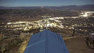 It starts at 5:20 am on Saturday, October 2024 and extends until 9:40 am after which it briefly pauses. Not much changed until 4 pm when the animation resumes and lasts until sunset showing the stratus layer quickly eroding. This was a very interesting meteorological phenomenon, and was likely due the easterly winds aloft bouncing along the top of the stratus deck through most of the day thanks to the stable atmosphere in the presence of a temperature inversion; temperatures in town did not rise above forty degrees until noon while it was above that up top by 9 am. There was plenty of dry air aloft thanks to the easterly winds downsloping off the Park Range, with relative humidities reaching as low as 25% by the afternoon. Finally, when town approached its high temperature of the day of 52 F, this dry air was mixed into the moist layer below and the stratus deck quickly eroded, with relative humidities in town only falling to 67%.
 We were greeted by another stratus layer this morning, though when the cloud is on the ground it is called fog, this time invading from the south as cool air drained down the South Valley, as shown by the second animation. It starts at 5:20 am and lasts through 11:20 am, and shows a more normal evolution of the fog layer due to the warming temperatures causing the fog to evaporate. The low elevation of the fog is apparent as Emeral Mountain stays visible in the background the entire morning, unlike yesterday when the stratus layer engulfed the mountain.
So we are left with a mostly sunny Sunday afternoon, but that won’t last as the eddy to our south begins to affect our area with more low-elevation rain showers and high-elevation snow showers that should begin around sunset. Winds from the south will eventually turn to be from our favorable northwest direction after midnight as the storm moves eastward, forcing air to rise as it encounters the Park Range and continuing the showers into the early morning, with 2-5” expected on the hill. Though there is not a lot of cold air associated with the storm, there may be enough to see some snowflakes in town by Monday morning.
Clouds will grudgingly depart by Monday afternoon, leaving high temperatures a degree or two below our average of 57 F. But locals know clearing skies behind a storm usually means a cold morning follows, and we could see the first hard freeze in the Yampa Valley on Tuesday morning, with temperatures falling to within several degrees of our average low of 25 F.
A flat ridge of high pressure is forecast to build over the West behind the storm, bringing sunny skies and warming temperatures five to ten degrees above average through the workweek. The pleasant weather may last through next weekend, and I’ll have more details about that in my next regularly scheduled weather narrative on Thursday afternoon.
Wintry storm to affect our weather on both sides of the weekend
Thursday, October 17, 2024
Temperatures in Steamboat Springs are in the upper-fifties late this Thursday afternoon under cloudy skies. A large and complicated wintry storm will bring two rounds of low-elevation rain and high-elevation snow to our area; the first as the storm approaches the Four Corners tonight through Friday and the second from Sunday afternoon through the night as the storm departs Colorado.
A strong and splitting storm currently over Nevada is forecast to first move into Arizona on Friday and form an eddy, then drift to the Four Corners by Sunday morning before quickly moving to the northeast across Colorado through the rest of the day. A cold front associated with the northern part of the splitting storm is on our doorstep, and combined with the moist flow from the south ahead of the soon-to-be eddy, we should see an active night of high-elevation snow showers and low-elevation rain showers.
We could see 1-4” of snow above 9000′ or so by Friday morning, and I’ve placed the latest two-hour movies of the Steamboat Powdercam and the Steamboat Mid-mountain Powdercam on the SnowAlarm home page so we can view the first snow of the season. If the images I download every twenty minutes are not available, the live-view videos can be accessed at the Steamboat Powdercam live view and the Steamboat Mid-mountain Powdercam live view.
The eddy will be strong enough to ingest some dry air from its southwest flank over Baja and create a lull in precipitation before noon on Friday. But afternoon and early evening showers will emerge again with another inch or two of snowfall possible above 9000′ by Saturday morning.
By then, the eddy will be over central Arizona, and while heavy precipitation is expected in southwest Colorado, our area will see gusty winds from the east as winds rotate counter-clockwise around the eddy. Easterly winds usually doom our precipitation chances due to downsloping off the Park Range, which results in drying and warming, so we should see a break in the precipitation lasting from early Saturday through Sunday morning.
By Sunday afternoon, the eddy is forecast to be over central Colorado, and we should see another round of precipitation begin as winds turn to be from our favorable northwest direction. More low-elevation rain showers and high-elevation snow showers should continue through Sunday night, leaving another 2-5” of snowfall near the top of the Steamboat Ski Resort.
Earlier forecasts had a colder event, but the splitting nature of the storm will keep the coldest air to our north. High temperatures in town will range from the high fifties to the low sixties through the weekend, right around our average of 58 F, with Saturday being the warmest day.
Mostly sunny skies should return on Monday, with temperatures again near average, before above-average temperatures return for the rest of the workweek. I’ll review the first part of the storm and have more details on the second half of the storm in my next regularly scheduled weather narrative on Sunday afternoon.


