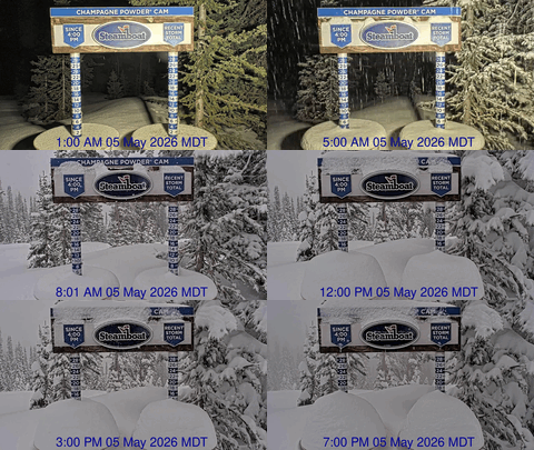
Snowy weekend ahead
Thursday, January 4, 2024
Temperatures are right around freezing with light snowfall in Steamboat Springs this Thursday mid afternoon. The current snow showers mark the start of a prolonged period of unsettled weather and increasing cold that will continue through the weekend and next week.
An area of low pressure is currently centered over the southern Rockies while the upstream Pacific jet stream is rippling with storms either developing or soon to develop. After an inch of snow fell this afternoon at the Steamboat Ski Resort, snow showers will continue on Friday and into Saturday morning as a weak but cold storm moves overhead late in the day. Thanks to winds from our favorable northwest direction, the cool, moist and unstable atmosphere should produce around 4-8” by the Saturday morning mid mountain report, with snowfall picking up Friday afternoon and continuing into Saturday morning.
High temperatures in town will fall to the mid twenties on Friday and the low twenties on Saturday, which is about five degrees below our average of 28 F. But low temperatures will be tempered by the insulating effects of cloud cover, and will likely be around or even several degrees warmer than our average of 4 F. And on the hill, mountaintop high temperatures will only reach around ten degrees on Friday and several degrees colder than that for both weekend days.
Snowfall should end for a time later Saturday before picking up again on Sunday as a stronger and colder storm approaches our area. Though the storm will be stronger, the track will be much further south and less favorable for our area as it moves across Las Vegas on Sunday and eventually New Mexico on Monday. The snow showers should be of fairly light intensity and continue through Sunday night, leaving 2-5” of accumulation on the Monday morning ski report.
Meanwhile, a large storm fueled by cold air from eastern Siberia and subtropical moisture is forecast to form over the Aleutian Islands on Sunday. The southerly flow ahead of the storm is forecast to form a large ridge of high pressure over and north of Alaska even as some of the storm undercuts this ridge and travels across the Gulf of Alaska early in the work week.
As you might expect, weather forecast models are still changing for next week, but cold arctic air sourced from near the North Pole and directed southward along the east side of the Alaskan ridge may combine with a piece of that Aleutian storm for a more significant storm around midweek, with lots more snow in continued cold temperatures behind it. So enjoy what will be our first snow since the spectacular Christmas storm, and be sure to check back for my next regularly scheduled weather narrative on Sunday afternoon where I’ll have more details about the upcoming cold and snowy week.


