Early week storm trending slower and weaker ahead of a break later Wednesday
Sunday, January 1, 2023
The snows have temporarily stopped over a cloudy Steamboat Springs this Sunday mid-afternoon with temperatures in the upper thirties in town and upper twenties near the top of the Steamboat Ski Resort. A storm currently near Las Vegas is forecast to move through our area starting tonight and eventually restart the snow showers that will likely last into Wednesday morning, though it is currently unclear if they start late tonight or Monday night. Colder temperatures will accompany the storm which should wind down on Wednesday morning and be followed by a break later Wednesday lasting into Friday ahead of the next modest storm for the beginning of next weekend.
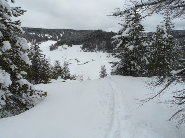
Steamboat Springs is digging out of the latest round of snows that started on Friday afternoon and left two day totals of 16” at mid-mountain and 22” up top as of the New Years Day ski report. Snowfall has temporarily stopped ahead of the next storm, which has formed into a difficult-to-forecast eddy currently near Las Vegas, and is forecast to move into northeastern Colorado on Monday night.
Earlier forecasts had significant snows over our area from later tonight through Monday, though the latest weather forecast model trends have weakened the storm and moved it further north. While the slower storm means only an inch or two at best on the Monday morning ski report at mid-mountain, conflicting guidance means a low confidence forecast for snowfall during the day, ranging from as little as 3” to as many as 14” for the Tuesday morning ski report.
While the precipitation forecast is uncertain, the colder temperatures are not, as cold air associated with the storm overspreads our area starting tonight. Look for high temperatures in town dropping to the low to mid-twenties, below our average of 27 F, and temperatures up top dropping toward 20 F on Monday and the low to mid-teens on Tuesday and Wednesday as reinforcing surges of cold air moves through on Monday night and Tuesday.
Snows should pick up with each of these reinforcements as favorable cool, moist and unstable northwest flow picks up behind the impulses. I’ve already pointed to the unpleasant uncertainty for snowfall during the day Monday, but there is more confidence in snow showers, moderate to heavy at times, occurring from Monday night through Tuesday night before they taper off around Wednesday morning, leaving 3-6” for the Wednesday morning report.
So we should see a break in the active weather starting Wednesday afternoon as a transient ridge of high pressure passes overhead on Thursday and brings a rare appearance of the sun. But the next modest storm keeps the ridge moving, with the possibility of more snow starting later Friday and lasting into Saturday. Be sure to check back to my next regularly scheduled weather narrative on Thursday afternoon when I’ll have more details on the storm to start next weekend.
Add comment
Fill out the form below to add your own comments


