Snow showers taper off through Friday ahead of nice start to the weekend
Thursday, November 11, 2021
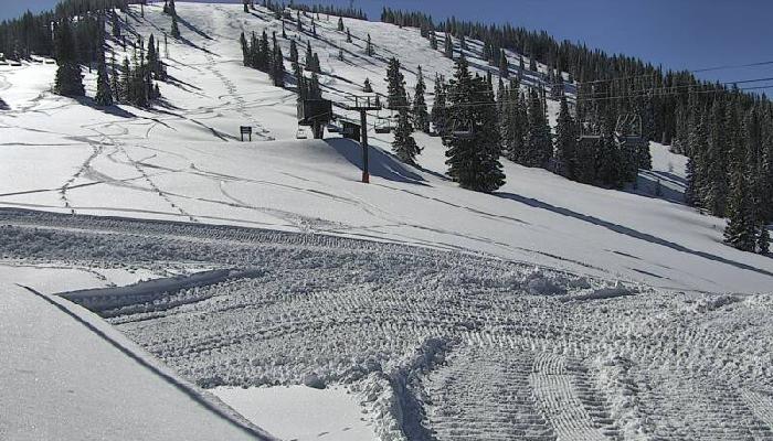
The Steamboat Springs area has finally seen some more wintry weather these last two days, with temperatures hovering around freezing in town late on this Thursday afternoon. Even though town did not see much snow, the Steamboat Powdercam at the top of Sunshine Peak is showing about 7 inches of snow accumulation so far, with some more coming tonight. Snow showers are forecast to taper off through Friday and may even hang on into Saturday morning at the higher elevations with dry and warmer weather forecast by Saturday afternoon. A cold front looks to graze our area on by Saturday night with precipitation likely staying just north and east of our area before warm and dry weather returns for the start of the following work week.
A ridge of high pressure over the West Coast is sandwiched between deep and cold areas of low pressure centered over the Gulf of Alaska and the upper Midwest. While the brunt of the current storm has passed, snow showers, some moderate, will continue through midnight or so in the favorable cold, moist and unstable flow from the northwest. Snow showers will taper off after midnight, though slowly, as they are forecast to continue through Friday and possible into Saturday morning at the higher elevations, with several more inches of snowfall possible.
Even though snow showers will hang on Friday at the higher elevations, temperatures will warm in town to around our average of 43 F as the West Coast ridge of high pressure is pushed over our area by energy ejecting out of the area of low pressure in the Gulf of Alaska. Skies clear and some sun returns by around noon on Saturday as temperatures warm into the fifties.
That energy ejecting from the Gulf is forecast to travel over the ridge and graze our area by late Saturday afternoon or night on its way eastward. Precipitation is currently forecast to stay to our north and east, so after a cool start to Sunday, temperatures return to the fifties by the afternoon.
Unfortunately for the projected opening of the Steamboat Ski Resort in a week from this Saturday, a ridge of high pressure is expected to move overhead for the beginning of the work week, with our next chance of colder weather and precipitation around midweek. I’ll certainly be talking about that in my next regularly scheduled weather narrative on Sunday afternoon.


