Wintry weather for most of the work week
Sunday, October 27, 2019
Temperatures so far this Sunday afternoon are running thirty degrees below our average of 53 F, and this is the warmer day of the next several! Snow showers increase tonight behind the first of two cold fronts, and after the snows taper off on Monday, a second even colder front moves through on Tuesday, with light and fluffy snow showers persisting through Tuesday and most of Wednesday. While precipitation looks to end by Wednesday night, the cold air will stick around for another day under sunny skies before moderating heading into the following nice weekend.
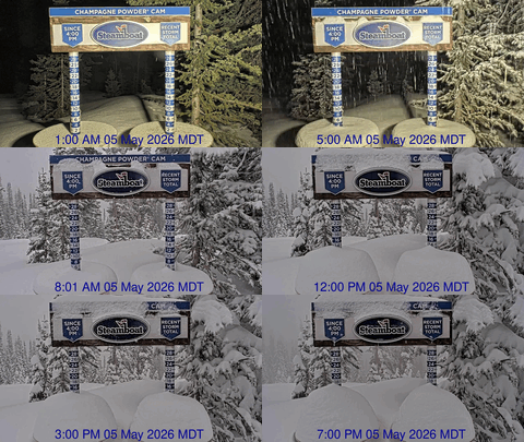
The mid-winter-like weather is courtesy of energy and moisture riding over a sharp ridge of high pressure off the West Coast and mixing with frigid air from near the North Pole. Snowfall between this afternoon and Monday afternoon is expected to be in the 5-10” range on the hill and 3-6” in town, and with the Steamboat Powdercam finally back up, we will finally be able to watch the snow accumulate at the top of Sunshine Peak.
The snows will taper off on Monday before restarting very early Tuesday when another blast of arctic air moves across our area before noon. While the water content of the snow will be quite low due to the cold air, snow densities will be quite high, allowing 6-12” of light and fluffy snow to fall on the upper mountain on Tuesday and Wednesday and another 3-6” in town.
If skies clear Wednesday night, temperatures are expected to plunge on Thursday morning to five to ten degrees below zero before returning to the twenties by the afternoon with sunny skies. Additional energy is expected to round the top of the ridge of high pressure off the West Coast, and bring a more seasonable and grazing shot of dry cool air for Friday, with temperatures climbing out of the dungeon by Saturday afternoon under continued sunny skies.
The winter-like weather takes a break for the weekend and early the following week as the West Coast ridge briefly encroaches inland, but a cold and wet pattern is advertised by the long-range models to follow.


