Dry and breezy cool front for later Sunday
Thursday, June 7, 2018
Not much change to the current beautiful weather conditions in Steamboat Springs is expected until later Sunday when a dry cool front associated with a grazing Pacific storm passes through our area. Daytime temperatures will remain above average under sunny skies through Saturday, and even become warmer ahead of the dry cool front currently timed for Sunday afternoon or evening.
Winds from the southwest will become gustier and increase on Sunday in advance of the front before turning to the west by Sunday night when the front passes Unfortunately, it will be quite dry and no rain is expected. While breezy conditions will continue on Monday, the cooler air behind the front will allow daytime temperatures to drop back towards average through midweek.
There appears to be some sort of tropical disturbance that is forecast to develop off the coast of Baja early in the work week, and this will conspire with the clockwise flow around a flat ridge of high pressure over the southwestern U.S to bring some moisture and likely meager precipitation chances northward over the Four Corner states starting around Wednesday, along with warming temperatures that will last through the rest of the work week.
There is uncertainty with respect to the the fate of this tropical disturbances and whether it interacts with another Pacific storm approaching the West Coast late in the work week. There is the possibility of wetting rains by around the following weekend or soon after if some of the current forecasts from the various weather prediction models verify.
Please note that I will write my next Sunday afternoon forecast on Monday as I will be traveling that day.
Dry and summery week ahead after a chance of showers this afternoon
Sunday, June 3, 2018
Other than some clouds and a chance of showers this afternoon and early evening, the weather over the Steamboat Springs area is forecast to be dry and summery for the coming work week. Some energy and moisture left behind from an earlier West Coast storm is currently moving over central Colorado and bringing some wetting rains to the very dry areas to our south.
The moisture may make it far enough north to bring some showers to our area later today before the small storm passes east of Colorado and ushers in some warm and dry summer-like weather for most of the remaining week.
On Monday, an approaching West Coast storm will decisively lose the battle with a building ridge of dry and warm high pressure over the central U.S. and end up barely grazing northern Colorado as it is shunted to our north, bringing breezier conditions during the day. There may be some slight cooling early Tuesday with a small chance of a shower along the higher terrain later that afternoon.
Otherwise, the weather looks meteorologically uninteresting, but sensibly spectacular through most of the upcoming week, with clear, cool nights and warm to hot sunny days.
There is some uncertainty for next weekend with respect to another West Coast storm that is forecast to eventually undergo the same fate as the early week storm; specifically, whether it will remain strong enough as it passes north of our area to re-introduce the chance of late-day showers around mid-weekend. At this time, it looks like they will be light and inconsequential at best.
Minimal precipitation chances this week after today
Wednesday, May 30, 2018
Behind the storm which brought cooler temperatures to the Steamboat Springs area on Monday and Tuesday, winds have switched to the southwest and temperatures have warmed ahead of another Pacific storm crossing the West Coast later today.
Our best chance for precipitation this upcoming week occurs today as a weak wave of energy containing some mid-level moisture moves overhead. But any storms this afternoon and evening are likely to bring more wind than rain as the lower levels of the atmosphere remain dry.
Temperatures will soar to summertime levels Thursday as breezy southwest flow continues ahead of the West Coast storm.
The storm is forecast to cross the Great Basin on Friday, and bring a mostly dry cool front through our area Friday afternoon or night. We’ll likely see at least some clouds overnight, and more seasonable temperatures on Saturday.
Temperatures will warm on Sunday, and more on Monday, even as a left-behind piece of the Friday cool front moves over southern Colorado and northern Arizona on Sunday. But any precipitation is currently forecast to be south of our area.
The weather looks to remain summer-like and dry for most of the rest of the upcoming work week as breezy southwest flow carries very dry air from the Desert Southwest over our area.
Afternoon showers possible through midweek
Sunday, May 27, 2018
A large and weakening storm loitering in the Great Basin this weekend will finally move to the northeast and graze the Steamboat Springs area through the early week period. Lobes of energy and moisture will continue to rotate around the storm, and one has dragged a weak cool front through our area today, with another stronger one forecast for Memorial Day. The atmosphere should remain quite dry today even in the presence of some clouds, so more wind than rain should be associated with any storms this afternoon.
But a better chance of some wetting rains will exist for the Memorial Day afternoon and evening as the storm moves very near to our area and brings a cooler day with seasonable temperatures.
Showers will again be possible on Tuesday as still cool, moist and eventually unstable northwest flow sets up over northern Colorado behind the departing storm.
Ahead of another Pacific storm approaching the West Coast early in the work week, the flow turns from northwest to southwest on Wednesday and temperatures rise to above normal again. A subtropical wave will move over Colorado and increase the chances of some warm Wednesday afternoon and evening storms.
Meanwhile, the Pacific storm is forecast to cross the West Coast midweek, and breezy southwest flow ahead of the storm will bring very warm and dry conditions to Colorado on Thursday and Friday.
Unlike the previous three storms, this once is not expected to stall over the Great Basin, and is forecast to graze northern Colorado early next weekend. The strength of the storm by the time it passes near our area is in question, so there may or may not be some noticeably cool air and the possibility of afternoon showers for the weekend.
Steamboat’s two seasons
Friday, May 25, 2018
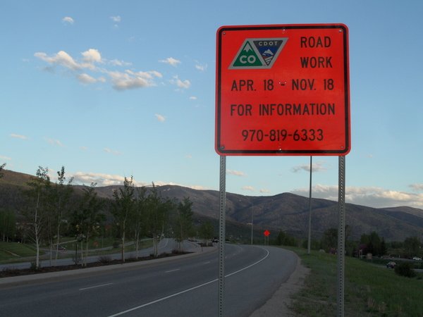
 You may think that Steamboat has four seasons, but apparently there are only two - ski season and construction season!
Sometimes, they overlap.
 For those traveling to and from our little corner of paradise this summer, CDOT is halting road construction on Rabbit Ears Pass during our busiest times. Check out their latest updates here.
SnowAlarm also has some live CDOT cams archived and available to loop, if you want to see what you are getting into. Check those out here.


