The storm that stayed away
Thursday, February 9, 2017
It’s hard to believe that we received so little snowfall from this storm, especially since all guidance pointed to significant accumulations.
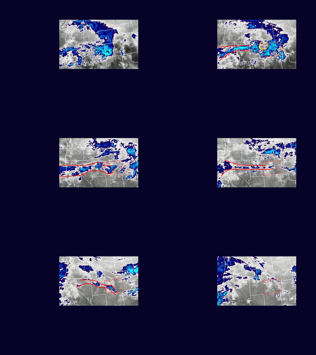
I’ve prepared a loop of the Western U.S. IR satellite from 1pm Tuesday, 7 Feb 2016 MST through 7am Wed when numerical models indicated the Steamboat Springs area would have the heaviest snowfall. Colorado is outlined in red, and there is a red dot in northwest Colorado that represents the location of Steamboat Springs. My 6-12” forecast was woefully wrong as we only received about 2” during the afternoon on Tuesday and some rain early Wednesday morning.
I’ve annotated some of the images in the loop to roughly outline the Pineapple Express snaking through the Great Basin. I’ve also highlighted a large dry area that appeared later Tuesday in yellow.
Rather than Pineapple Express, meteorologists have started calling these wet events with a tropical and/or subtropical connection Atmospheric Rivers, as that descriptive term better captures the sometimes thin and wavy moisture feed.
Two features that likely doomed snowfall for the Steamboat Springs area were the large dry area highlighted in yellow that moved over our area late Tuesday afternoon, and the thinning Atmospheric River of moisture that passed just south of us Tuesday evening. The southern movement of the Atmospheric River was due to the passage of a correctly forecast weak cool front. There were periodic enhancements along the I-70 corridor that contributed to some 10” reports as the Atmospheric River moved south, but the big winner was Monarch that reported 17” and was the result of the Atmospheric River loitering over that area before it became diffuse and moved back north as a warm front overnight. The passage of this warm front brought the rain and gusty winds observed very early Wednesday morning.
But still, how could the models have gotten it so wrong? This Atmospheric River event was relatively narrow in width and I believe that made it’s measurement problematic. Upper air moisture is measured by balloons released every 12 hours, but their locations are several hundred miles apart or more. It becomes difficult to accurately measure and resolve a narrow band of moisture, and all of the numerical models were initialized with a broader extent of moisture than was actually present.
The result was that snowfall produced under the Atmospheric River was narrower and spottier in areal extent than forecast. This was exacerbated by the narrowing of the Atmospheric River in the latter half of the storm.


