Storm cycle ends with seasonal weather returning by Thursday
Tuesday, November 5, 2013
Another 5.5” of fluffy snow was on my deck by this morning as the impressive winter-like storm departs.
Wednesday will be cold with our area susceptible to showers in the cold, but rapidly drying northwest flow as a trailing wave moves over the area.
A building ridge will produce moderating temperatures and dry weather through the weekend and likely most of next week. Weak waves do pass north of our area on Friday and again next Tuesday, but high clouds will likely be their only affect on our weather.
Models do forecast a large storm off the west coast after mid-month that is forecast to eventually influence this ridge, but the forecast pattern is around 10 days away and confidence in a solution that far in the future is low.
Snow to redevelop this afternoon as the winter-like storm continues
Monday, November 4, 2013
The first wave brought about 6.5” of snow on my deck by this morning as strong southerly flow overran the cold front that moved through the area late in the afternoon yesterday.
After a break early today, light precipitation will begin again by the late afternoon and grow heavier as upward motion from the main part of the storm still situated to our west begins to affect the area.
The bulk of the precipitation will fall overnight and snowfall will be decreasing during the day Tuesday after producing another 4-8” of snow. Strong vertical forcing looks to create precipitation bands which are difficult to localize but will produce moderate to heavy snowfall rates. Temperatures should fall to the coldest levels of the season as skies clear behind the main part of the departing storm.
Wednesday will be cold with our area susceptible to showers in the cold, but rapidly drying northwest flow as a trailing wave moves over the area.
A building ridge should produce a beautiful Thursday. The storm for next weekend looks to be weakening and accelerating so that only light showers are expected on Friday. Seasonal temperatures and dry weather is forecast for the weekend.
Winter-like storm will bring snow through Wednesday
Sunday, November 3, 2013
The complex and winter-like storm will consist of three waves of energy, bringing unseasonably cold air to the area by late Tuesday. The first weak wave grazes the northern portion of Colorado tonight, bringing light to moderate precipitation to the area by Monday morning.
After a break early in the day Monday, light precipitation will begin again by the late afternoon and grow heavier as upward motion from the main part of the storm still situated to our west begins to affect the area.
While earlier forecasts had forecast a split tin the wave, current models indicate the wave moving bodily through mid-day Tuesday. As a result, the bulk of the precipitation will fall overnight and snowfall will be decreasing during the day. Temperatures should fall to the coldest levels of the season as skies clear behind the main part of the departing storm.
Wednesday will be cold with our area susceptible to showers in the cold, but rapidly drying northwest flow as a trailing wave moves over the area.
A building ridge should produce a beautiful Thursday. The storm for next weekend looks to be weakening and accelerating so that only light showers are expected on Friday. Seasonal temperatures and dry weather is forecast for the weekend.
Departing storm leads to a beautiful weekend before another significant storm approaches Sunday night
Friday, November 1, 2013
After another 3” fell overnight here on my front deck near the base of the Steamboat Ski Area, drier condition should overspread the area by tonight, although showers will persist at least this morning in favorable, but drying northwest flow.
A beautiful weekend with seasonal temperatures looks to be sandwiched between the currently departing storm and next very significant one forecast to impact the entire Rocky Mountain region for the next work week.
This next complex storm will consist of three waves of energy, with the last bringing unseasonably cold air. The first weak wave will pass over southern California early in the weekend and be over our state by Sunday. Light precipitation may occur over the southern-most areas, but the north will remain dry until the second wave preceding the main event approaches Sunday night.
As this weak wave passes over the area, light precipitation will continue in cool but seasonable temperatures during the day Monday. Meanwhile, the bulk of the storm will continue to develop to our west as the unseasonably cold air associated with the third wave strengthens the storm.
A split develops in the storm as the storm is stretched between the departing second wave and approaching third wave. The third wave looks strong enough to form a closed low that moves over the state on Tuesday. Very strong forcing looks to create precipitation bands which are difficult to localize but will produce moderate to heavy snowfall rates.
The last wave should be east of the Divide by late Tuesday and will finally drag the coldest air of the season over the state, producing significant and likely impressive snow amounts. Wednesday will be cold with our area susceptible to showers in the cold, but rapidly drying northwest flow.
A building ridge should produce warmer than average temperatures by the end of the work week and most of Saturday before yet another storm affects us by Sunday.
More fall colors from from the Steamboat Ski Area
Monday, September 30, 2013
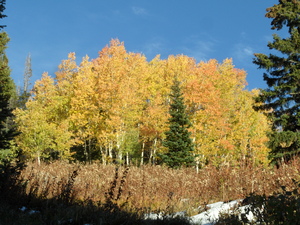
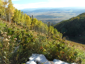 It’s remarkable what a day of sun will do to dry out the mountain, as I was able to ride to 9000 feet and snap some more pictures of our rapidly evolving fall landscape. The picture on the left was taken from Duster looking down towards Moonlight and highlights the South Valley of Routt County. The picture on the right is a similar perspective, but vertically oriented.
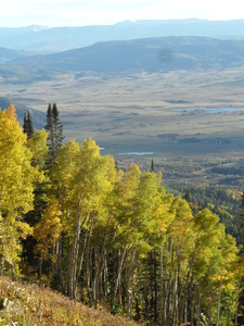
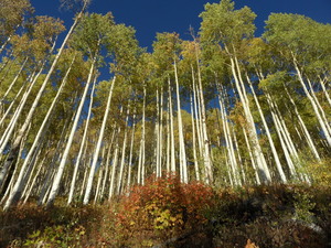 Moving further up Duster towards Rendezvous Lodge, the picture on the left was taken from Duster looking up into the Twilight trees. Lastly, the picture on the right was taken near Rendezvous saddle looking up towards High Noon.