
Last round of precipitation to come later today

Sunday, October 20, 2024
After an extended period of low clouds and fog, the sun is out this Sunday noon in Steamboat Springs with temperatures around fifty degrees, headed toward the low sixties. But a wintry storm bringing significant snow to southwestern Colorado, including the first snowfall of the season of two inches at the Steamboat Ski Resort Friday morning, is not done with us yet. Low-elevation rain showers and high-elevation snow showers will redevelop around sunset and last through the night before skies grudgingly clear Monday ahead of a warm and dry workweek.
 An eddy of low pressure is over the Four Corners and is forecast to move across central Colorado today before reaching the corner of northeastern Colorado on Monday. Ahead of the storm center, our area saw good precipitation, with thunderstorms leaving around a half-inch of rain in town late in the day on both Thursday and Friday, with the first snowfall of the season at the Steamboat Ski Resort showing two inches at mid-mountain by first thing Friday morning.
As expected in my last weather narrative on Thursday, easterly winds aloft wrapping around the low pressure eddy squashed any precipitation chances on Saturday. Unusually, town was left with a thick stratus deck invading from the north, associated with the low-level cold front from the northern part of the storm, that lasted much of the day as shown in the first animation. 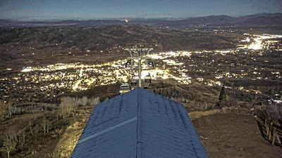 It starts at 5:20 am on Saturday, October 2024 and extends until 9:40 am after which it briefly pauses. Not much changed until 4 pm when the animation resumes and lasts until sunset showing the stratus layer quickly eroding. This was a very interesting meteorological phenomenon, and was likely due the easterly winds aloft bouncing along the top of the stratus deck through most of the day thanks to the stable atmosphere in the presence of a temperature inversion; temperatures in town did not rise above forty degrees until noon while it was above that up top by 9 am. There was plenty of dry air aloft thanks to the easterly winds downsloping off the Park Range, with relative humidities reaching as low as 25% by the afternoon. Finally, when town approached its high temperature of the day of 52 F, this dry air was mixed into the moist layer below and the stratus deck quickly eroded, with relative humidities in town only falling to 67%.
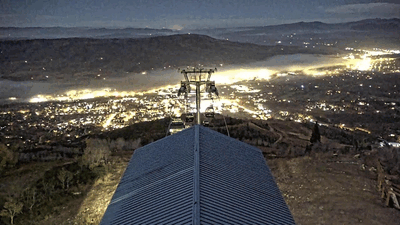 We were greeted by another stratus layer this morning, though when the cloud is on the ground it is called fog, this time invading from the south as cool air drained down the South Valley, as shown by the second animation. It starts at 5:20 am and lasts through 11:20 am, and shows a more normal evolution of the fog layer due to the warming temperatures causing the fog to evaporate. The low elevation of the fog is apparent as Emeral Mountain stays visible in the background the entire morning, unlike yesterday when the stratus layer engulfed the mountain.
So we are left with a mostly sunny Sunday afternoon, but that won’t last as the eddy to our south begins to affect our area with more low-elevation rain showers and high-elevation snow showers that should begin around sunset. Winds from the south will eventually turn to be from our favorable northwest direction after midnight as the storm moves eastward, forcing air to rise as it encounters the Park Range and continuing the showers into the early morning, with 2-5” expected on the hill. Though there is not a lot of cold air associated with the storm, there may be enough to see some snowflakes in town by Monday morning.
Clouds will grudgingly depart by Monday afternoon, leaving high temperatures a degree or two below our average of 57 F. But locals know clearing skies behind a storm usually means a cold morning follows, and we could see the first hard freeze in the Yampa Valley on Tuesday morning, with temperatures falling to within several degrees of our average low of 25 F.
A flat ridge of high pressure is forecast to build over the West behind the storm, bringing sunny skies and warming temperatures five to ten degrees above average through the workweek. The pleasant weather may last through next weekend, and I’ll have more details about that in my next regularly scheduled weather narrative on Thursday afternoon.


