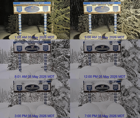
Unsettled week starts with our next storm Sunday
Saturday, March 17, 2018
The second part of a complex storm has just pounded the Sierras, with over 40” of snow being reported over the last day at Squaw Valley and Alpine Meadows. The storm will evolve as most of it moves eastward across the Great Basin today, bringing a strong cold front through the Steamboat Springs area around noon on Sunday. This is at least twelve hours later than my last update, so there is no need for powderhounds to set the alarm. However, travelers may want to get their skiing in early as travel will likely become difficult again after the cold front passes, similar to last Thursday.
The storm has a lot going for it, including instability, intensification as it eventually moves east of our area, cold air, moisture and northwest flow, which is ideal for the Park Mountain Range where the Steamboat Ski Area is situated.
We will likely see periods of heavy snow Sunday afternoon during and after the cold front passes, with 2-4” of relatively dense snow expected by the time the lifts stop turning. Snows will continue overnight with an additional 3-6” of increasingly light and fluffy snow.
We may also see some Steamboat Magic Monday morning, where there is accumulations between report time and ski time, before snows decrease towards noon as temperatures rise. However, another weak piece of the storm moves overhead after noon, likely increasing showers again before they end for a time Monday night. I hate to use such a large range of snowfall estimates for an entire day, but we could see 1-4” of before noon on Monday and another 1-4” of snow for later in the day.
Though temperatures will warm starting Tuesday after a chilly start to the day, more moisture will be carried over or just north of our area by a leftover piece of the storm from Tuesday afternoon through Wednesday morning. If the moisture is far enough south, we may see some clouds and the possibility of some snow showers, with accumulations most likely at higher elevations and closer to the Wyoming border.
Meanwhile, another storm, warmer and wetter than the previous storms, takes shape off the West Coast early in the work week and is forecast to move inland around midweek. The American GFS is faster than the European ECMWF, perhaps by a lot, bringing clouds and showers to our area as early as Thursday morning.
Unfortunately, the storm will start off quite warm, and the relatively low elevation of Steamboat means rain showers at the lower elevations and snow showers at the higher elevations during the day. Incidentally, our low elevation, while providing for relatively long mountain summers, also means March is not our snowiest month, as is the case for most of the higher elevation Colorado ski resorts.
Snow levels should lower to the Yampa Valley bottom overnight Thursday, if the faster American GFS solution ends up closer to being correct. While we generally do not do well with the predominantly southwest winds forecast for the storm, we could pick up significant accumulations later Thursday and into Friday as the coldest part of the storm moves over our area.
Uncertainty increases for next weekend as the American GFS advertises a break in the weather while the European ECMWF keeps colder and more unsettled weather over our region.
Save your soles! If you do any walking in your ski boots on hard surfaces, then you know the grating and grinding sounds you hear can’t be good. In fact, worn boot soles make your binding unsafe as it interferes with the boot-binding interface. Cat Tracks are a flexible protector that keeps your boot soles pristine, and adds a cushion for walking comfort. When it’s time to click into bindings, I take them off and stash them in my coat pocket. Yaktrax
are similar, but I have not used them since they appear they would take up a bit more space in my jacket pocket. But you get a rocker sole that promotes a natural stride which may be worth the space sacrifice. If I did not have to carry them around all day, these would be my choice.


