
Another round of Tuesday powder makes for great skiing
Tuesday, March 18, 2014
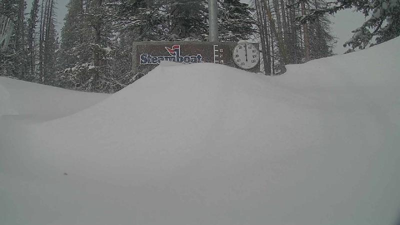
The Steamboat ski area reported 3” mid / 5” top at 5 am this morning, and by 1 pm the report had 7” mid / 10” top. Interestingly, there was 3” up top at 4 am and it snowed about an 1” / hr between 4 am and 9 am, except for a 2.5” burst between 4 am and 5 am - now THAT is Steamboat Magic!
More magic was in force on the other side of the Sunshine Peak ridge as over 16” of snow was measured in the early afternoon near the base of the Morningside lift! Satellite loops showed a persistent convective cell in the area from about 7 am to 2 pm that was likely the cause of the enhanced snowfall rates. And I measured as much of 20” in the Second Pitch!
Similar to last Tuesday, the skiing kept getting better as the snow accumulated and covered the last run’s tracks. The upper half of the upper mountain skied great all day, while the lower half benefited greatly from the additional snowfall during the day.
The first time I was in Shadows, for example, the lower parts were still crunchy, so I went over to the Twilight trees seeking a flatter pitch so as to keep above the hard surface. The skiing here was soft through the whole run, as expected. In fact, I did about four runs in a row as I kept finding untracked lines, and even the pitch below Duster skied great.
It seemed there was less snow over in the Rolex trees, but the Sundown and Priest Creek liflines skied soft and effortlessly. The 3:30 trees still had big swaths of uncut powder when I finally left that to check out what the additional snow had done for Shadows. By then, I was measuring almost a foot in the favored locations, and the skiing turned great for the entire run as the crunchies were well buried.
After several more runs in Closet and Shadows, I jumped into Morningside and was greeted by the 16”. It was a bit shocking to see that much snow back there, and I had enough time to lap Wake Up Call three times off the top - with face shots on the initial steep pitch. After that, one more hike to the top to ski the East Face, and then over to the Second Pitch to sample the 20”.
It’s always nice to be reminded of mid-winter skiing in the springtime, especially when the snow quality is fantastic!
Snow later today through Wed. morning
Monday, March 17, 2014
Clouds have overspread our area ahead of a strong cold front expected to pass through the area later this afternoon towards sunset. This system will bring sharply colder temperatures tonight and tomorrow, and snows lasting through Wednesday morning. Additionally, northwest winds will increase later today and likely last through much of the night, though the Steamboat ski area is fairly well protected from northwest flow. I would expect 2-4” by tomorrow morning and an additional 3-6” by Wednesday morning as a trailing wave passes over our area late Tuesday to keep snows going through the night. This storm may be similar to the one last Tuesday which produced outstanding skiing during the day.
Skies should clear later Wednesday and temperatures warm as a small ridge builds over our area. This pleasant weather should last into the weekend before a grazing wave to our north brings slightly cooler temperatures and some upward forcing to the region that might sustain showers later Saturday and possibly into Sunday.
Another ridge builds into our area after the weekend for a nice few days, but it appears March will go out like a lion as additional energy from the Pacific interacts with the still present and very cold Hudson Bay vortex.
Snows for Saturday, Tuesday and likely next weekend
Thursday, March 13, 2014
A weak wave passes to our north today while the meandering piece of the previous storm to our south and west passes south of us tomorrow. Neither of these will significantly impact our weather, with slightly cooler temperatures today and perhaps some clouds later tonight or tomorrow.
I expect cooler temperatures and light snow most of the day Saturday as a relatively dry Pacific wave slides down the eastern side of the west coast ridge. Models have been trending further east with this wave which minimizes our snowfall; currently I expect maybe an inch for the Saturday morning report and 2-5” during the day which will be reported Sunday morning.
A cool start Sunday should give way to sunny and warm weather later in the day and lasting through noon Monday as the west coast ridge moves over our area. The American model has trended closer to the European model for a possibly significant storm starting Monday night and lasting through Tuesday.
A quick moving ridge will bring nice weather for midweek until another Pacific wave may affect us by the end of the workweek or weekend. Long term models have an unsettled period of weather commencing then and likely lasting for at least the rest of March.
Great skiing yesterday
Wednesday, March 12, 2014
The Steamboat ski area reported 3” mid / 1” top Tuesday morning, and the report for this Wednesday morning was 4” mid / 8” top, with almost all of the reported snow today occurring during the day yesterday.
I’d like to point out an inconsistency in the morning report; the 5am report is apparently composed of a measurement around 4:30 am at mid-mountain, while the top measurement is called in by a snow cat driver closer to 3 am, at least based upon the report yesterday morning and the pictures provided by the powdercam located next to the measurement stake.
The end result is that disparities between the 5 am mid and top measurements should be discounted since the top measurement is not taken at the standard time. Indeed, the top did NOT receive 5” of snow between 5 am and 9 am yesterday morning as reported; it received 5” between 3 am and 9 am, and 3” between 5 am and 9 am, similar to what mid-mountain received.
So I headed up yesterday mid-morning for the 6” of snow, and several snow showers during the morning and early afternoon kept the runs skiing fresh as we eventually netted 8” mid / 9” top. Closet into Shadows first thing was generally very good until the crunchy sub-surface was exposed about half way down. Skiing was better and more consistent in the more northern aspects of Closet and Sideburn.
Twilight and both skier’s right and left of that drainage skied great as the pitch was shallow enough and the still-accumulating snows deep enough to separate the skier from crunchies underneath. Same for Rolex, and generally the top half skied better than the bottom half all day.
I had planned for only a couple of hours of skiing, but the conditions kept improving during the day. North St. Pats skied great, as usual, though by then easterly winds had picked up creating a smooth surface of wind-packed snow. As the winds increased for my last run, No Names provided great shelter and snow.
Those easterly winds played havoc with the snow measurement site - check out the drifting at about 3:45 pm yesterday; the location was buried 15 minutes later!
A break in our spring weather with snow and cold for Tuesday
Monday, March 10, 2014
After another spring-like day today, a splitting storm very similar to the one on Friday, but cooler, affects our area beginning around midnight tonight. Moderate snows are likely as the front barrels across the region very early Tuesday morning, with 2-4” expected by report time.
But the system splits around us as a wave traveling around the ever-present-for-this-winter Hudson Bay vortex drags a piece of the storm across the Continental Divide while leaving the remaining piece to meander westward to Utah and eventually Nevada. It does appear another piece of energy will keep lighter snows going until noon after which they become more showery before ending around sunset. I would expect another 2-4” during the very cool day which will be reported on the Wednesday morning report.
After a cool start Wednesday morning, a quick warm up lasting into Thursday is forecast as the west coast ridge tries to rebuild over our area. However, a Pacific wave traveling over this ridge will phase with the storm left to our south and west later Thursday forcing the complex east of the Continental Divide by Friday. Models initially had some precipitation from that Pacific wave for Friday, but current trends are pointing towards a dryer solution.
The ridge rebuilds for possibly another stellar weekend, but lots of uncertainty with the forecast for next week as more Pacific energy interacts with the west coast ridge.


