
More wet weather to arrive for the weekend
Thursday, October 9, 2025
Temperatures are near seventy degrees this Thursday mid-afternoon in Steamboat Springs with a mix of sun and clouds. After several gorgeous fall days with mostly sunny skies, the increasing clouds mark the arrival of tropical moisture from a former hurricane that will bring significant rainfall to our area on Friday and Saturday. A strong cold front this mid-weekend follows, bringing cool and showery weather to start Sunday, with moisture decreasing from Sunday afternoon through the beginning of the next workweek.
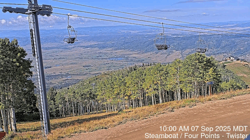 The changing fall colors have migrated to the lowest elevations, and leaves are dropping rapidly. To celebrate this spectacular fall, I have a month-long time-lapse from Steamboat’s Four Points cam starting September 7th that looks down Twister toward the South Valley. The color peaked for the three days starting on September 22 at around 9,700′, right on schedule, progressing downward in elevation before peaking two weeks later at around the 9,080′ level of Thunderhead Lodge. Both September 23, our first snowfall, and September 27 were omitted due to the cloudy conditions.
Now, a ridge of high pressure sits over Texas, an eddy of low pressure lies off the Pacific Northwest coast, and former Hurricane Priscilla is moving northeastward between these features. Enough moisture has made it to our area for a quick shower that just now left a tenth of an inch of rain near the Steamboat Ski Area.
But this is just a prelude; a much stronger push of moisture arrives Friday morning, starting showers before noon that will last through the rest of the day and overnight. Meanwhile, the eddy off the Pacific Northwest will be pushed eastward by a storm moving through Alaska, eventually ingesting some cold from western Canada as the two storms briefly phase by Saturday afternoon.
Showers will continue on Saturday and overnight as some of the Alaska storm is absorbed into the eddy and some moves southward along the West Coast. A cold front is forecast to move through late Saturday night or early Sunday, bringing snow levels down to 8,500′, or possibly 8,000′, though only minor accumulations are expected as the coldest air arrives as the moisture is dwindling.
After high temperatures in the low sixties on Friday and Saturday, right at our average of sixty-two degrees, the showers on Sunday morning should end by the afternoon, with some sun appearing, though high temperatures will be relegated to only the low fifties in the cool post-frontal air mass.
Between the departing storm and the new storm forming along the West Coast, temperatures will rebound to around average to start the work week with a mostly sunny Monday morning. However, uncertainty arises as early as Monday afternoon, as moisture from another tropical system off the coast of Baja may or may not be directed northeastward toward our area by the southwest winds ahead of the new storm and behind the eastward-moving Texas ridge of high pressure.
Let’s hope for the forecast beneficial rainfall, and I’ll have more details on the West Coast storm in my next regularly scheduled weather narrative on Sunday afternoon.
Add comment
Fill out the form below to add your own comments


