
Some shower chances to start the week
Sunday, September 28, 2025
Temperatures have fallen from around seventy degrees to the mid-sixties this Sunday afternoon in Steamboat Springs as some thunderstorms passed to our east and west. There is a chance for additional showers this evening as the first part of an approaching storm moves overhead, with the second part bringing less chances for showers on Monday afternoon. Energy ejecting from a large and cold storm now in the Gulf of Alaska will graze our area on Tuesday afternoon for another chance of showers before drier weather appears starting Wednesday and lasts through the workweek.
An eddy that was over central California has moved into Arizona, stretching northeastward into Colorado as a piece of energy ejects from the storm. The rumbles of thunder and shower chances will continue through the evening before resuming again Monday afternoon as the remaining piece of the eddy moves overhead.
Meanwhile, the large and cold Gulf of Alaska storm will rotate towards the West Coast, crossing it on Monday and grazing our area as it is deflected to the northeast by a ridge of high pressure over the Midwest. Tuesday will have another chance of afternoon and evening showers, with high temperatures similar to Monday and near seventy degrees.
Additional upstream energy is forecast to strengthen and stall the original Gulf of Alaska storm over the Pacific Northwest by midweek. Drier air will be carried over our area by southwest winds ahead of the storm, allowing a degree or two of warming for Wednesday and mid-seventies on Thursday.
The Pacific Northwest storm is forecast to move toward our area as additional energy moves through the Gulf of Alaska, though there is weather forecast model uncertainty regarding the speed of the storm. We may see cooler, wetter weather as soon as Friday, or it may be delayed until the weekend.
That will become clearer by my next regularly scheduled weather narrative on Thursday afternoon. Until then, be sure to get outside and enjoy the fall spectacle while there is still good color, as the mid and high-elevation aspen are starting to shed their leaves.
Gorgeous weekend to end with showers
Thursday, September 25, 2025
Perfect temperatures in the low seventies and sunny skies are over Steamboat Springs late this Thursday afternoon. The gorgeous weather will continue through Saturday, offering plenty of opportunity to enjoy the spectacular colors of fall. An approaching storm may bring some clouds by Saturday afternoon, ahead of possible showers by Sunday afternoon and evening.
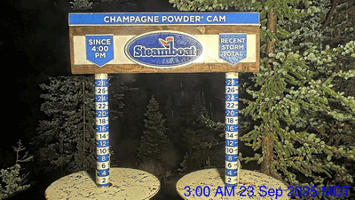 A ridge of high pressure over the Rockies is sandwiched between an eddy of low pressure over central California and the trough of low pressure extending southwestward from the Great Lakes which brought us our First Snow on Tuesday. I’ve included a time-lapse of the Steamboat Powedercam at the top of Sunshine Peak between 3 am, when the first flakes started falling, and 1 pm, when most of the accumulation was over.
But after just over an inch of precipitation in town between Saturday and Tuesday, the ridge of high pressure overhead has brought quintessential Colorado fall weather featuring beautiful sunny days and cool, clear nights. The aspen trees and underbrush have been provoked into a brilliant show of color, as shown by one of the many pictures I snapped today near Buffalo Pass.
 Friday and Saturday should offer similarly nice weather to get out and enjoy the show, with possibly some clouds by Friday afternoon as a storm well to our north moves across Montana and Wyoming, and Saturday afternoon as the California eddy is eventually forced northeastward by a developing storm in the Gulf of Alaska.
There is still uncertainty with the evolution and track of the eddy, which is currently predicted to wobble for a few days over southern California before moving to Arizona on Sunday, and being absorbed into the southwest winds of the jet stream ahead of the Gulf of Alaska storm as it moves across Colorado on Monday.
Monsoonal moisture carried northward by southerly winds rotating counterclockwise around the eddy will reach us as early as Saturday afternoon, with some possible cloudiness. We’ll likely see a mostly cloudy Sunday, with a chance of afternoon and evening showers as energy ejecting from the weakening eddy lifts the monsoonal moisture, causing condensation as the lifted air cools. What is left of the eddy will pass over our area on Monday, bringing another chance of showers.
Meanwhile, the Gulf of Alaska storm is expected to rotate toward the West Coast through the weekend and may or may not affect us around midweek, depending on its strength and track. I’ll have more details about that in my next regularly scheduled weather narrative on Sunday afternoon. In the meantime, be sure to get out and enjoy the spectacular colors on display at all elevations around town this weekend.
Cold and wet weather to start the workweek, with First Snow possible
Sunday, September 21, 2025
Temperatures are in the upper sixties with partly sunny skies this Sunday mid-afternoon in Steamboat Springs. An approaching Pacific Northwest storm commemorating the autumnal equinox, which occurs at 2:19 pm on Monday, will bring cool and wet fall weather to start the workweek. Along with showers lingering on a cool Tuesday, we may see the first dusting of snow atop the Steamboat Ski Area on Tuesday morning. But any snowfall won’t last for long as warming temperatures and mostly sunny skies are forecast to start on Wednesday and last into next weekend.
 A storm in the Pacific Northwest will move through Idaho tonight and split on Monday, with the southern end of the storm briefly forming an eddy that moves over western Colorado on Tuesday. Weather forecast models have struggled with the evolution of this storm for a while, only recently settling on a further west and wetter solution, as is often the case with Pacific Northwest storms.
We should be able to eke out another seventy-degree day today, right near our average of seventy-one degrees, before cool air begins to filter into the region on Monday. A good chance of thunderstorms will precede the cool air tonight ahead of the storm, with a lesser chance on Monday as high temperatures only reach the mid-sixties.
While the bulk of the storm will move southward to the west of the Continental Divide, showers are likely along and behind a cold front late Monday afternoon or early evening, lasting through the night and into Tuesday. Temperatures up top fall toward freezing overnight and early Tuesday morning, meaning we may see the First Snow of the season atop the Steamboat Ski Area.
 While we won’t see those snowflakes in town, we won’t escape the very fall-like weather on Tuesday, with morning showers that may extend into the afternoon and high temperatures mired in the mid-fifties. By Tuesday afternoon, though, the counter-clockwise winds around the eddy to our south will bring gusty easterly winds, drying the air as it downslopes off the Park Range to our east and ending the showers.
The storm is expected to quickly exit the state by Tuesday night, allowing a ridge of high pressure to build overhead starting Wednesday. Clear skies with lots of sun will allow temperatures to rebound into the upper sixties on Wednesday and back into the low seventies for Thursday, beginning a period of quintessential Colorado fall weather that may last through next weekend.
The foliage is rapidly changing, with great color above 9,000′, as shown in the pictures I took while mountain biking at the Steamboat Ski Resort on Saturday, as well as in the lower-elevation drainages. The show should continue through next week, with the views of the high-elevation aspen possibly dependent on the wind associated with the storm. Be sure to take advantage of Colorful Colorado, and I’ll have more weekend details in my next regularly scheduled weather narrative on Thursday afternoon.
Nice Friday to be followed by an unsettled weekend
Thursday, September 18, 2025
Temperatures are in the comfortable mid-sixties with sunny skies this Thursday mid-afternoon in Steamboat Springs. Warmer temperatures on Friday will be accompanied by increasing clouds as moisture from the remnants of a tropical disturbance begins moving overhead, increasing shower chances during a mild weekend.
The storm system that brought as much as a tenth of an inch of rain over the last several days and our first early-morning frost of the season is now in the Dakotas, allowing a transient ridge of high pressure to build over the Rockies ahead of a low pressure area off the coast of California. Moisture from the remnants of former Tropical Cyclone Mario has been injected into some energy ejecting from the California low, bringing afternoon clouds on Friday as high temperatures rise toward seventy-five degrees, just above our average of seventy-two degrees.
The moisture and incoming Pacific energy will conspire to bring a chance for showers on both Saturday and Sunday, most likely later Saturday into Sunday morning. The mild air mass means high temperatures will be most affected by periods of afternoon cloudiness, falling to near average on Saturday and around seventy degrees on Sunday.
Meanwhile, cold air moving through the Bering Sea will strengthen a storm forecast to develop in the Gulf of Alaska on Saturday. This storm was originally forecast to graze our area on Monday, but weather forecast models are struggling to accurately predict the amount of cold air that will enter the storm, affecting the weather forecast for the start of the workweek.
That uncertainty will be better resolved in time for my next regularly scheduled weather narrative on Sunday afternoon. In the meantime, be sure to enjoy the nice start to the weekend and the rapidly developing fall colors.
Pleasant weather ahead and behind a midweek storm
Sunday, September 14, 2025
After several days of cool and wet weather, the sky is clearing, with temperatures around sixty degrees early this Sunday afternoon in Steamboat Springs. A nice Monday will be followed by unsettled weather ahead of and behind a cold front later Tuesday, lasting through Wednesday. A warming trend begins Thursday, leading to a nice start to next weekend.
 Over a half-inch of rain fell between Thursday and today, with the season’s first snowflakes falling at the top of the Steamboat Ski Resort for a short time Saturday evening, and a dusting of snow atop Chet’s Dream chairlift at Loveland this morning.
The departing storm has allowed the sky to clear, though the cool air mass behind the storm will keep high temperatures in the upper sixties, below our average of seventy-four degrees.
However, another storm that crossed the Pacific Northwest coast earlier today quickly follows. A transient ridge of high pressure ahead of the storm means a pleasant day on Monday with high temperatures approaching our average.
As the storm moves across Idaho on Monday, a stationary front forms along the Colorado-Wyoming border, bringing increasing clouds on Tuesday with high temperatures knocked back toward seventy degrees. The front will transition into a cold front by Tuesday afternoon or evening, bringing showers that will continue overnight and Wednesday, with high temperatures on Wednesday back to the mid-sixties.
Like the past storm, a ridge of high pressure over the central U.S. will remain strong enough to hinder the storm’s eastward motion, stalling it over Nebraska, with a chance of showers possible on Thursday afternoon. However, temperatures will rebound, with high temperatures returning to the low seventies.
Meanwhile, another storm developing in the Gulf of Alaska is forecast to make landfall along the British Columbia coast midweek. The storm will likely split, with the bulk of the storm moving across the U.S.-Canadian border and forcing the Nebraska storm eastward into the Midwest. While we should see a beautiful, mostly sunny Friday, with high temperatures rising into the mid-seventies, the amount of energy in the southern part of the split, which forms an eddy off the coast of California, may determine our chances for showers next weekend.
Enjoy the beautiful days today and Monday, hope for more rain from the midweek storm, and I’ll have more details on shower chances for the weekend in my next regularly scheduled weather narrative on Thursday afternoon.


