
Gorgeous weekend to end with showers
Thursday, September 25, 2025
Perfect temperatures in the low seventies and sunny skies are over Steamboat Springs late this Thursday afternoon. The gorgeous weather will continue through Saturday, offering plenty of opportunity to enjoy the spectacular colors of fall. An approaching storm may bring some clouds by Saturday afternoon, ahead of possible showers by Sunday afternoon and evening.
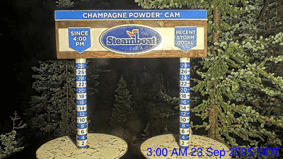 A ridge of high pressure over the Rockies is sandwiched between an eddy of low pressure over central California and the trough of low pressure extending southwestward from the Great Lakes which brought us our First Snow on Tuesday. I’ve included a time-lapse of the Steamboat Powedercam at the top of Sunshine Peak between 3 am, when the first flakes started falling, and 1 pm, when most of the accumulation was over.
But after just over an inch of precipitation in town between Saturday and Tuesday, the ridge of high pressure overhead has brought quintessential Colorado fall weather featuring beautiful sunny days and cool, clear nights. The aspen trees and underbrush have been provoked into a brilliant show of color, as shown by one of the many pictures I snapped today near Buffalo Pass.
 Friday and Saturday should offer similarly nice weather to get out and enjoy the show, with possibly some clouds by Friday afternoon as a storm well to our north moves across Montana and Wyoming, and Saturday afternoon as the California eddy is eventually forced northeastward by a developing storm in the Gulf of Alaska.
There is still uncertainty with the evolution and track of the eddy, which is currently predicted to wobble for a few days over southern California before moving to Arizona on Sunday, and being absorbed into the southwest winds of the jet stream ahead of the Gulf of Alaska storm as it moves across Colorado on Monday.
Monsoonal moisture carried northward by southerly winds rotating counterclockwise around the eddy will reach us as early as Saturday afternoon, with some possible cloudiness. We’ll likely see a mostly cloudy Sunday, with a chance of afternoon and evening showers as energy ejecting from the weakening eddy lifts the monsoonal moisture, causing condensation as the lifted air cools. What is left of the eddy will pass over our area on Monday, bringing another chance of showers.
Meanwhile, the Gulf of Alaska storm is expected to rotate toward the West Coast through the weekend and may or may not affect us around midweek, depending on its strength and track. I’ll have more details about that in my next regularly scheduled weather narrative on Sunday afternoon. In the meantime, be sure to get out and enjoy the spectacular colors on display at all elevations around town this weekend.
Add comment
Fill out the form below to add your own comments


