Workweek to stay cold and turn dry behind snow showers on Monday night and Tuesday

Sunday, January 12, 2025
Mostly sunny skies and cool temperatures near twenty degrees in town and five degrees near the top of the hill are over Steamboat Springs late this Sunday afternoon. The arctic air mass of the last storm will keep the cold temperatures around through the workweek with mostly sunny skies arriving for Wednesday afternoon and Thursday. More arctic air and another storm are possible near the beginning of the long Martin Luther King Jr. weekend.
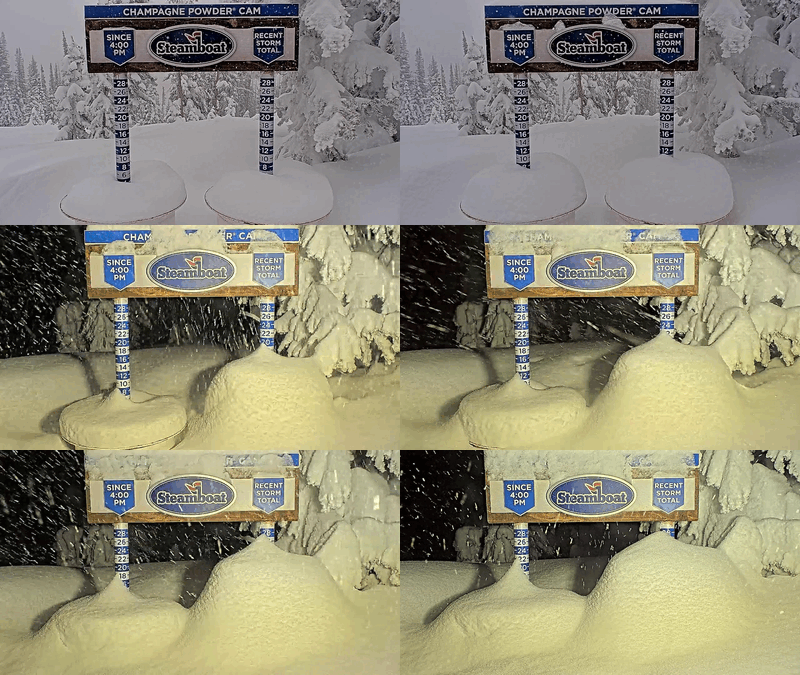
 The weekend storm started as expected with 5” reported at mid-mountain and 6” up top for the Saturday morning report. While it sometimes snowed hard during the morning, a short break early Saturday afternoon was quickly followed by heavy snow showers with snowfall rates over an inch per hour between 4 pm and 11 pm. More impressively, A time-lapse of the Steamboat Powdercam with images every twenty minutes showed two inches of snowfall in the twenty minutes between 4:00 pm - 4:20 pm, 5:00 pm - 5:20 pm and 8:20 - 8:40 pm, which equates to snowfall rates of six inches per hour!
 Perfect temperatures for the growth of dendrites, the classic branch-shaped snow crystal that creates dry and fluffy powder, a very unstable atmosphere with sufficient moisture, and weak storm energy combined to create the surprise. The SNOTEL at Buffalo Pass indicated the snow likely contained about 5% water, which equates to a snow-liquid water ratio of 20:1.
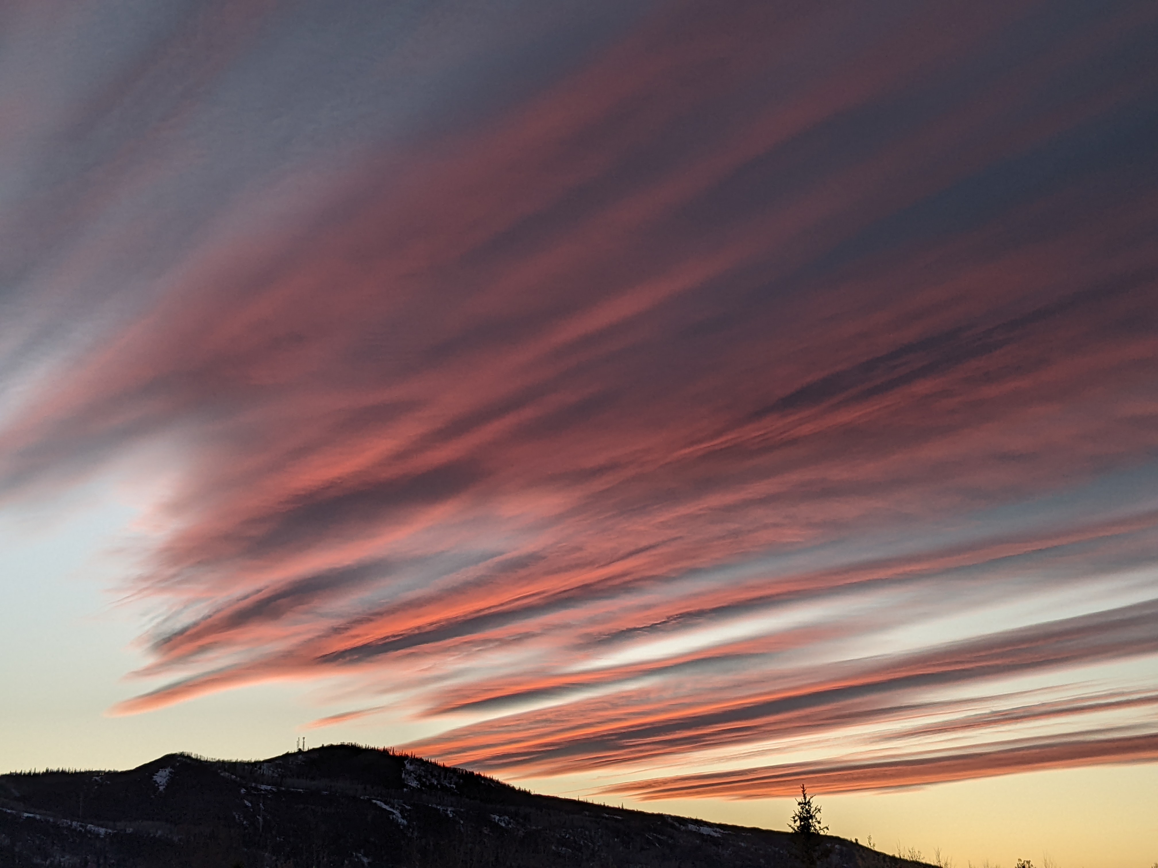
The result was 28” in 24 hours at the top of the Steamboat Ski Resort by Sunday morning, with 17” of that occurring after the lifts closed. Mid-mountain reported 15” in 24 hours, with 9” occurring after the lifts closed. And the sun appeared by mid-morning today, creating a sparkling winter landscape!
Now, an expansive trough of low pressure is over most of North America while a ridge of high pressure extends south from Alaska down the West Coast. A couple of waves of energy and cold air rounding the ridge and eventually moving to the southwest will reinforce the arctic air mass tonight and tomorrow, bringing colder temperatures and the chance for some light high-elevation snow showers Monday night and Tuesday.
Low temperatures will be subzero and around ten degrees below our average of 4 F through Wednesday morning, with high temperatures in town mired in the teens, over ten degrees below our average of 29 F. But a storm extending southward from the Aleutian Islands is forecast to move eastward through the workweek, forcing the ridge of high pressure toward our area. We should see mostly sunny skies by Wednesday afternoon that last for Thursday, helping temperatures to approach average on Wednesday and several degrees above average on Thursday.
The Aleutian storm is forecast to mix with another arctic air mass as it approaches our area early next weekend. More snow is possible, along with more cold temperatures. Enjoy the wintry workweek ahead, and I’ll have more details about the possible weekend storm in my next regularly scheduled weather narrative on Thursday afternoon.


