Spectacular weather to continue this week

Sunday, September 29, 2024
Temperatures are around seventy degrees, again on their way into the low-eighties, under mostly sunny skies this Sunday noon in Steamboat Springs. Despite some cooling starting tomorrow, mostly sunny skies and high temperatures in the mid to upper-seventies will persist through the work week and into the following weekend.


 The 84 F high temperature in town last Wednesday broke the previous record for the date set in 2015 by one degree. Even though the official data are yet to be published by the weather station near the high school, we should be challenging the previous records of 83 F set in 2001 on Friday, 2010 on Saturday and 2019 today.
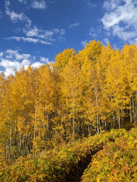
The warm sunny days and clear crisp nights with lows in the mid to upper-thirties and low forties, between five and ten degrees above our average of 31 F, have allowed quite the color spectacle to appear over the area, as shown by some recent photos.
The current weather is due to a ridge of high pressure over most of the West. An eddy of low pressure over central California has pulled a modicum of moisture northward toward our area, while a quick-moving wave of low pressure has moved through Vancouver.
We may see more afternoon clouds today and perhaps even an insignificant afternoon or evening shower ahead of the Vancouver storm which is forecast to sweep across the northern Rockies on Monday.
Ahead of a cool front from the storm tickling our region late Monday or early Tuesday, breezes from the west will pick up later today and especially Monday, perhaps shaking some leaves off the colorful display. High temperatures will drop into the upper-seventies on Monday and the mid-seventies on Tuesday, still well above our average of 68 F.
The grazing cool front will be our only weather this week, with mostly sunny skies and mid-seventy temperatures persisting through the work week and into the weekend. There was a chance for a pattern change around next weekend, but current weather forecast models have the western ridge of high pressure deflecting or weakening any incoming Pacific weather systems.
So enjoy the summery weather ahead, and check my next regularly scheduled weather narrative on Thursday afternoon to see if this gorgeous weather persists through next weekend.


