Cold front tonight might bring snowflakes to the Yampa Valley floor
Sunday, September 19, 2021
 After around a tenth of an inch of rainfall around the town of Steamboat Springs last night, temperatures are in the low sixties this Sunday noon with a mix of clouds and sun. A potent cold front this evening brings some snow to the higher elevations and perhaps even some snowflakes to the Yampa Valley floor by Monday morning. Much colder temperatures are expected to start the work week behind the front, with below freezing temperatures on Tuesday morning, before the sun returns and temperatures warm to around average by midweek.
An unseasonably cold storm currently moving through the Intermountain West has just brought some snow to the summit of Grand Targhee, with similar conditions expected for the Steamboat Ski Resort this evening. Ahead of the storm, temperatures should rise to around seventy degrees today, right at our average, with the possibility of a passing shower before the cold front arrives around mid-evening.
While moisture rapidly increases with the windy cold front, it also rapidly decreases behind it, so expect some good rain showers at the lower elevations and snow showers at the higher elevations, with the stronger showers perhaps briefly allowing snowflakes to reach the valley floor. Another push of cold air is forecast after midnight and before sunrise, accompanied by some showers which may again bring some snowflakes to town. All told, we may see around a quarter or third of an inch of precipitation by Monday morning.
Temperatures should be around freezing Monday morning, with likely clouds tempering the low temperatures, before the skies clear and a mix of sun and clouds return, though high temperatures will be mired in the fifties. A reinforcing surge of dry cold air arrives Monday night, and with the forecast clear skies, low temperatures will plummet to ten to fifteen degrees below our average of 34 F. Simply covering plants may not be enough to stave off the hard freeze, so consider harvesting whatever fruits and vegetables that are still growing.
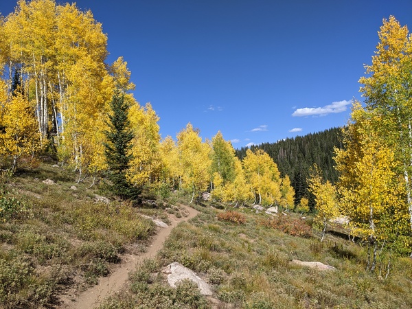
A ridge of high pressure begins to move over the Rockies on Tuesday, so despite the cold start to the day, temperatures are expected to rise into the sixties with plenty of sun. This should begin an extended period of prime leaf-peeping as the low elevation underbrush and higher elevation aspen, shown in the included picture taken Friday on the Flash of Gold trail, are now turning. Even more warming is advertised for Wednesday as temperatures recover to around average.
Another incoming storm forecast to move through the Gulf of Alaska on Tuesday is forecast to move that ridge of high pressure to our east, though there is weather forecast model uncertainty as to how much of the storm forms an eddy in the vicinity of the Great Basin or further southwest and how much continues east. We may see a drop in temperatures by a few degrees on Thursday according the the American GFS, but along with plenty of sun as the grazing cool front will be dry.
Weather forecast models should have a much better handle on how much of the storm lingers over or southwest of the Great Basin for the weekend, and I’ll have details on whether that might affect our weekend weather in my next regularly scheduled weather narrative on Thursday afternoon.


