
Some pictures from Spring 2017
Saturday, June 10, 2017
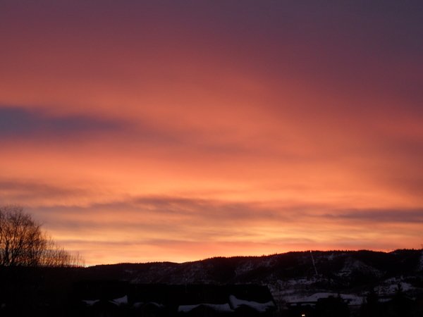 I wanted to get some pictures posted before the current summer-like weather progresses any further! This sunset was taken on 13 March 2017
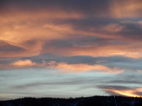
 Another one taken on 13 March 2017.
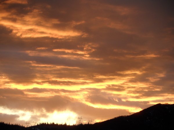
 A sunset from a few days later on 18 March 2017.
 Taken on April Fools Day 2017 - No joke!
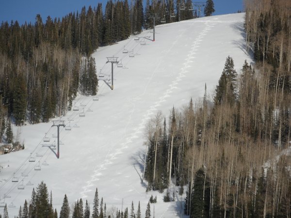
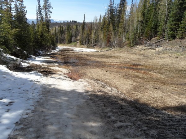 After 2 months with hardly any snowfall, winter returned during the week after the Steamboat Ski Area closed for the season. A trip to Winter Park after a couple of feet of snow was followed the following week by a hike on 3 May starting at the base of the Thunderhead lift. Conditions were ‘grassy’ and ‘muddy’ at the bottom! I had to take off my skis about a half-dozen times to navigate around the unskiable areas.
 I hiked to the top of Four Points and took the following photo from Flat Out. Two weeks later later, after about 10 days of mountain biking, we received a foot of snow in town on 18 May and I did my last hike of the spring the next day. I would have taken some pictures, but skied down in a raging snow squall. Turns were difficult as we had another freezing rain event and there was a crust on the snow, so best that day was not documented. And skiing down Vagabond was treacherous as the foot of snow fell on bare ground - I probably should have just skipped that last outing!
Quintessential Colorado summer days ahead
Thursday, June 8, 2017
Plenty of sunshine will be on tap for the next week as the current summer-like weather continues through the weekend. Currently, a ridge of high pressure over the Rocky Mountains has brought above normal temperatures and dry air to the Steamboat Springs area, eliminating the chances for our typical afternoon thunderstorms.
A strong and cold storm is bringing precipitation to the Pacific Northwest coast, and some energy will eject from this storm and travel well to our north over the weekend. However, the Rocky Mountain ridge will be flattened and moved eastward by the strengthening southwest flow around the storm, bringing breezy southwest winds and more dry air from the desert southwest over our region.
The Rocky Mountain ridge rebuilds for a short time around Sunday ahead of the slowly moving Pacific storm moving eastward across the Great Basin. Even though the ridge will serve to deflect the parent storm north of us towards Montana, keeping precipitation to our north, the storm is potent enough to bring an unseasonably strong cold front through the area around Monday. If the southern end of the storm had any appreciable moisture, we would see snow below 8000′ by Tuesday morning! But just much cooler temperatures will be noted for the beginning of the work week under continued breezy conditions as the front barrels through the region and backs the winds from the southwest to the west.
Winds will slacken and temperatures will warm back to normal on Wednesday, and stay that way for the rest of the work week, with any chances of precipitation confined to the end of this forecast period.
Cooling on Tuesday followed by increasingly hot and dry weather
Monday, June 5, 2017
A wave currently located along the northern Montana border has flattened the western U.S. ridge of high pressure that brought this past weekend’s spectacular weather. This grazing storm will drag a weak cool front through northern Colorado later this afternoon and evening and storms will be possible as this boundary moves through the Steamboat Springs area.
Some storms will also be possible on a cooler Tuesday afternoon as lingering moisture and instability from the front remain over our area.
The western U.S. ridge rebounds on Wednesday, bringing warming temperatures and perhaps a stray afternoon shower as the strong surface warming acts on any remaining moisture in the atmosphere.
Drier air and hot temperatures invade the Intermountain West for the rest of the work week with meager chances for precipitation.
While we are basking in mid summer-like weather, a strong and powerful storm approaches the Pacific Northwest coast around Thursday. However, seasonality dictates that the battle between the storm and the ridge will be dominated by the ridge, at least through the weekend. The main affect on our weather will be the appearance of breezy southwest winds ahead of the storm that will make only slow eastward progress through the weekend.
Breezy conditions will persist into the beginning of the work week. Models now generally agree that some sort of cool front will be dragged through our region around Tuesday as the Pacific Northwest storm eventually moves eastward, and this will bring cooler temperatures and a chance of showers for the day.
Weak storm today followed by typical summer-like weather
Thursday, June 1, 2017
A splitting Pacific storm is currently moving across the Great Basin. While most of the storm will avoid Colorado, increasing moisture and upward motion ahead of the storm will bring good chances for showers to the Steamboat Springs area this afternoon and tonight.
Lingering energy and moisture will fuel the chance of afternoon thunderstorms on Friday as the northern part of the storm moves towards the Great Lakes.
The last forecast discussed the possibility of the southern part of the split possibly affecting our weather on Saturday, but numerical weather forecasts now have that area of low pressure well to the south of northern Colorado. Drier air moves over our region behind the departing northern part of the storm leading to a very pleasant Saturday.
Late in the weekend another storm crosses the Pacific Northwest coast. As earlier predicted by the European ECMWF, a building ridge of high pressure over the Rockies will shunt the slow-moving storm first to our northwest and then to our north. The ridge will be flattened over our area by the grazing storm, and this will lead to a small chance of afternoon storms on Sunday and a better chance on Monday and Tuesday as the airmass is destabilized by cool air aloft associated with the storm.
Temperatures will warm again starting on Wednesday and continuing through the rest of the work week as a ridge of high pressure rebuilds over the Intermountain West behind the grazing storm.
Nice weather turns unsettled near the end of the work week
Monday, May 29, 2017
Energy traveling southward along the western periphery of a large storm near the Great Lakes has kept seasonably cool temperature in place for the Steamboat Springs area. There will be a threat of afternoon and early evening storms today, with gusty winds likely as most of the precipitation will evaporate in the dry sub-cloud layer before reaching the ground (virga). This evaporation will cool the air beneath the cloud, forcing it first downward as it becomes negatively buoyant and then outward as it encounters the ground.
The diffuse area of low pressure talked about in the last forecast looks to stay south of northern Colorado through midweek, allowing a ridge of high pressure to build over the Intermountain West. Mostly sunny skies and warm temperatures are expected with only a slight chance of afternoon storms for Tuesday and Wednesday.
A splitting Pacific trough of low pressure approaches the West Coast midweek, and the first effects will be much increased chances of afternoon storms on Thursday as some moisture to our south is carried northward by the southwest flow ahead of the trough.
The southern end of the splitting trough looks to move over Colorado on Friday, bringing a weak cool front through the area with showers likely during the day.
By Saturday, Colorado will be caught in the somewhat chaotic and slow-moving area of the split flow, leading to more chances for showers, though likely less numerous and intense than on Friday.
On Sunday, the Steamboat Springs area looks to be in either drier flow from the southwest or moderately unstable flow from the north as some of the northern split interacts with more energy rotating southward from central Canada. At this point, the forecast could be either dry or unsettled.
Models agree that another storm will cross the West Coast late in the weekend, but disagree on its position. The Amercian GFS has the further south solution compared to the European ECMWF, and would bring another round of cooler temperature, showers and unsettled weather for the beginning of the new week.


