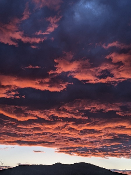
Steamboat Springs area short term weather forecast from Tuesday night
Tuesday, April 5, 2016
Spring will return Wednesday after a brief blast of winter moved over our area today.
Warming temperatures and abundant sunshine will be on tap for the rest of a very pleasant work week before a possibly prolonged period of wet and relatively warm weather starts around Saturday afternoon.
Steamboat Springs area short term weather forecast from Monday night
Monday, April 4, 2016
A weak front will pass through the area tonight bringing breezy westerly winds and rain showers to the valleys and snow showers to the hill after midnight, possibly leaving an inch or two on the mountain by the morning ski report.
A quick-moving storm from the Pacific Northwest passing through our area on Tuesday will bring continued snow to the mountain and snow showers to the valleys with breezy to windy northwest winds and even the possibility of some thunder in the afternoon.
Models are struggling with the southern extent of the system, but an additional 3-6” may fall on the mountain by the time the precipitation ends Tuesday evening, with little or no accumulations in the valleys.
Skies will clear and spring will return for midweek into the beginning of the weekend before a possibly prolonged period of wet and relatively warm weather starts around mid-weekend.
Steamboat Springs area short term weather forecast from Sunday night
Sunday, April 3, 2016
After another spring day Monday, with even some afternoon and evening showers possible later in the day, winter returns on Tuesday as a quick-moving storm from the Pacific Northwest brings snow to the mountain and snow showers to the valleys with breezy to windy northwest winds.
Models are struggling with the southern extent of the system, but if the stronger solution verifies, as much as 4-8” of snow may fall on the mountain during the day and into the evening Tuesday, to be reported Wednesday morning.
Skies will clear and spring will return for midweek into the beginning of the weekend before a possibly prolonged period of wet weather starts around mid-weekend.
Storms for Tuesday and Closing Day followed by very active week
A very complicated jet stream pattern over the next two weeks will affect our weather in the Steamboat Springs area, with Pacific waves from the northwest and then southwest traveling over our area and possibly mixing with cold air from the Canadian Plains.
After a couple of spring days today and tomorrow, with even some afternoon and evening showers possible later Monday, winter returns on Tuesday as a quick-moving storm from the Pacific Northwest brings snow and breezy to windy northwest winds to the area. Models are struggling with the southern extent of the system, but currently it looks like 4-8” of snow will fall during the day and into the evening Tuesday, to be reported Wednesday morning.
Skies will clear and spring will return for midweek into the beginning of the weekend before a possibly prolonged period of wet weather starts around Closing Day and extends through the following week.
A piece of the Tuesday storm, left behind and loitering west of Baja during the week, is forecast by some models to be pushed over our area mid-weekend by another strong and cold Pacific storm upstream. The storm will initially be warm due its vacation west of Baja, bringing rain to the valley and snow to the higher elevations around Saturday afternoon of Closing Weekend.
The cold Pacific storm upstream is forecast to split around a rapidly building Gulf of Alaska ridge, and models are struggling with how much energy is partitioned in the northern and southern streams of the split. Furthermore, cold air from the Canadian Plains is forecast to push westward toward the northern Rockies and mix with the northern stream of the split, while the southern stream is forecast to undercut the Gulf of Alaska ridge and approach our area early the following work week.
There is a lot of energy in the Pacific, and at least the American GFS is forecasting an active and wet period for the following week. It’s a shame that Steamboat is currently planning to close as the mountain bases will likely continue to build through April. Would the possibility of a 400” season induce them to stay open another week? Take it upon yourself to convince them!
Steamboat Springs area short term weather forecast from Saturday night
Saturday, April 2, 2016
A ridge to our west will move over our area by Monday ahead of a quick-moving wave in northwest flow timed for Tuesday. But first, a minor wave traveling over the top of the ridge on Sunday brings some clouds and perhaps isolated showers to our area later in the day, especially on the mountain.
Monday looks to be similar to Sunday but a bit warmer with some afternoon instability producing scattered showers later in the day.
The next Pacific Northwest storm threatens our area beginning Tuesday and likely lingering into Wednesday, with models struggling on the southward extent of the wave and the amount of cool air drawn into it from the Canadian Plains. At this point, it looks like a moderate snow event on the mountain with breezy to windy northwest winds, though details will surely evolve as the storm approaches.


