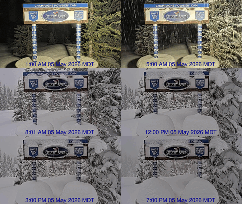
Steamboat Springs area short term weather forecast from Saturday night
Saturday, January 23, 2016
A weakly splitting Pacific storm will cross the area tomorrow bringing some gusty west winds and starting snow again. The initial part of the storm looks to split around Steamboat Springs early Sunday before trailing waves in northwest flow cross the area Monday afternoon and possibly Tuesday morning, keeping the snow around until as late as Tuesday afternoon for the higher valleys and the mountain.
Saturday night: Cloudy with lows near 10 in Craig and teens in Steamboat.
Sunday: Highs in the 20’s before a cold front passes through our area from a weakly splitting storm early in the day and starts up snow again with 2-4” in Craig and the mountain and 1-3” in Steamboat. Breezy along and behind the front with winds up to 25 mph.
Sunday night: Snows continue with 1-3” in the valleys and 3-6” at the Steamboat ski area leaving 4-9” for the Monday morning report. Lows in the single digits in Craig and around 10 in Steamboat.
Monday: Light snow with accumulations around an inch in the valleys and another 2-4” for the mountain as additional pieces of energy move through the area. Highs around 20 in the valleys and teens at mid-mountain.
Monday night: Chance of continued snow, especially on the mountain with lows around zero.
Steamboat Springs area short term weather forecast from Friday night
Friday, January 22, 2016
Warming weather is expected until early Sunday when a Pacific storm affects our area. Temperatures will drop during Sunday with snow likely during the day and overnight as winds veer from the southwest to the northwest.
Friday night: Lows in the minus single digits for Craig and around 10 in Steamboat.
Saturday: Partly sunny skies becomes cloudy in the afternoon as the Sunday storm approaches. Highs in the 20’s in Craig and mid-mountain and 20’s in Steamboat.
Saturday night: A small chance of snow very late with lows around zero in Craig and teens for Steamboat.
Sunday: Snow with accumulations around 1-3” in the valleys and 3-6” on the hill. Winds backing from southwest to northwest during the day with falling temperatures. Highs in the 20’s in the valleys and near 20 at mid-mountain.
Sunday night: Snow diminishing near Craig with lows in the single digits. A trailing wave will cross our area in cool, moist northwest flow early Monday morning keeping snow going in Steamboat and the mountain. Another 1-3” inches possible in Steamboat and 3-6” on the mountain, yielding a 6-12” ski report for Monday morning. Lows around 10 in Steamboat.
Steamboat Springs area short term weather forecast from Thursday night
Thursday, January 21, 2016
Cold morning valley temperatures and warming mountain slopes will occur over the next few days before the next storm threatens our area on Sunday.
Tonight: Lows around minus 10 in Craig and single digits in Steamboat with patchy fog possible.
Friday: Mostly sunny with highs around 20 in Craig and mid-mountain and around 30 in Steamboat.
Friday night: High clouds may moderate the valley temperature inversions, with lows in the minus single digits in Craig and around 10 in Steamboat.
Saturday: Partly sunny weather will turn cloudier through the day, with highs around 20 in Craig, 30 in Steamboat and 20s at mid-mountain.
Saturday night: There may be some snow showers late depending upon the speed of the next storm. Lows around 10 in Craig and teens in Steamboat.
Steamboat Springs area short term weather forecast from Wednesday night
Wednesday, January 20, 2016
The last storm of this storm cycle is moving east of our area, bringing some cold air and dry conditions for the rest of the week before another Pacific storm threatens our area by late Saturday or early Sunday. Mountain slopes will warm for Friday and Saturday while valleys start the day cold as temperature inversions form.
Wednesday night: Snow showers will end this evening for the valleys with under an inch in Craig, around an inch or possibly two in Steamboat and 2-4” for the mountain leaving 5-10” for the Thursday morning ski report. Lows around zero in Craig with some fog possible, and around 10 in Steamboat.
Thursday: Becoming partly sunny during the day first in the valleys and then on the mountain. Highs in the teens in Craig and the mountain and near 20 in Steamboat, with patchy fog possible in the valleys early in the day.
Thursday night: Clear and very cold with lows in the minus teens around Craig and near zero in Steamboat.
Friday: Sunny and highs in the 20s in Craig with patchy fog in the morning. Highs around 30 in Steamboat and 20 on the mountain.
Friday night: Lows around -10 in Craig and 10 in Steamboat.
Snows ends by Thursday before starting up again late in the weekend
This is a summary of the detailed weather discussion.
The last wave in the storm cycle passes over the area this afternoon and tonight, ending snows by tomorrow morning as the sun makes an appearance for Thursday. Very cold valley temperatures will be observed by Friday as temperature inversions reform, though the upper elevations will warm noticeably by Friday and stay warm for Saturday.
Another storm is forecast for late Saturday or early Sunday, and is forecast to keep snow going through Monday before ending by late Monday night or very early Tuesday morning. Tuesday should be dry before a grazing wave in northwest flow brings a chance of snow back for Wednesday.
A break in inclement weather is then expected before a possibly large and complex storm threatens our weather for the last weekend in January.


