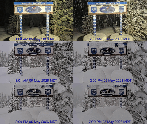
More snow and very cold this week
Sunday, February 18, 2018
Some of the frigid air over Hudson Bay in eastern Canada has moved westward this past week, mixing with and intensifying Pacific storms riding over a ridge of high pressure near the Gulf of Alaska. The next weather-maker for the Steamboat Springs area and our state is currently near the British Columbia / Washington coast and is moving southward.
Southwest winds will strengthen today as the storm continues moving south through Monday before turning eastward and entering the Great Basin. The southwest flow will mix with some remnant energy left off the southern California coast from last Friday’s storm, and begin snow showers over Mt. Werner after midnight tonight.
And similar to last Friday, the usually unfavorable southwest flow should bring good snowfall as ejecting energy and moisture travel over a stalled cold front over or near our area on Monday. Due to the late start of the showers tonight, I would expect only 1-4” on the Monday morning report, but another round of Steamboat Magic, where there are accumulations between the report time and ski time, is possible.
Snows should continue through the day as the southward progress of the cold front is stalled by the southwest flow. Sometime in the afternoon or evening, perhaps around sunset, the cold front will blast through the area with a period of moderate to heavy snowfall and plunging temperatures, contributing to difficult travel conditions.
Though moisture decreases behind the front, the coldest temperatures since last December will lead to light and fluffy snow overnight Monday. I’ll guess at 3-6” during the day Monday, with another 3-6” of lighter and fluffier snow overnight, leading to 6-12” for the cold Tuesday morning report.
Snowfall will continue Tuesday, but become lighter and more showery before ending overnight, with an additional 1-4” to be reported on a very cold Wednesday morning.
Unsettled weather will continue through the entire work week and following weekend as additional waves of Pacific energy travel over the top of the ridge near the Gulf of Alaska and continue to mix with the cold air over western Canada.
The timing of the waves are uncertain, but right now, light and non-accumulating snow showers are advertised for later Wednesday, light but accumulating snows for later Thursday, and better snows for Friday and later Saturday into Sunday.
It looks like we will finally have a snowy February as the long-term forecast for unsettled weather continues into March.
Don’t let the cold weather that’s coming shorten your ski day. My new favorite cold-weather glove are all about warmth. And when combined with the standard HotHands handwamers which I use below about 5F, I’m good for the day. Three fingers sit together with the index finger separated, but there is enough room to scrunch all your fingers together while on the lift, which is especially nice if you have a handwarmer in the mitten-part of the glove.


