
Some moose, fall color and sunsets from the past month
Saturday, November 12, 2016
 Continued warm and sunny days have allowed for a great fall mountain season that looks to continue for several more days until winter arrives about a week before the Steamboat Ski area official opening.
The moose are also out on the trails enjoying the beautiful weather. The picture of the one on the right was taken yesterday on 11 Nov on the Creekside trail right below the Pioneer merge.
The picture of the two moose below was taken on 9 Oct as they rested on lower Tenderfoot. They weren’t moving and they weren’t looking like they would be moving, so I backtracked to find a detour around the family.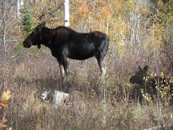
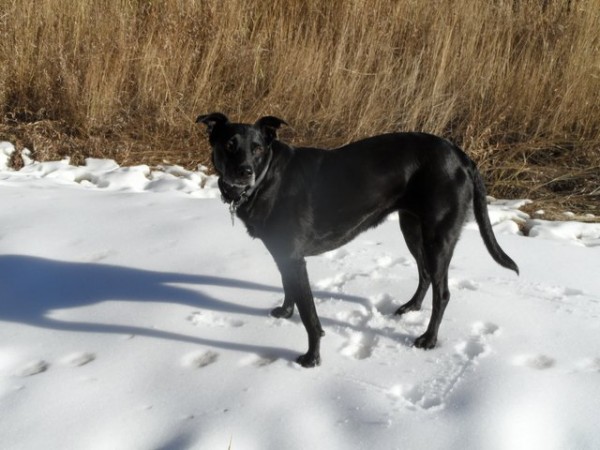 On the way up Zig Zag yesterday, Milly surveyed the latest efforts by the Steamboat Ski area’s excellent snowmaking crew. There were some isolated islands of snow she could roll around on, but winter will have to wait for a few more days.
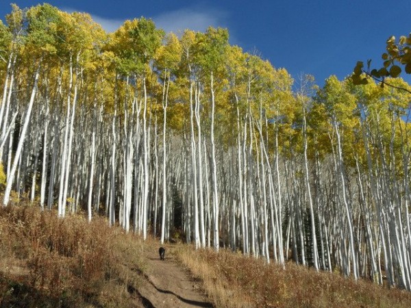
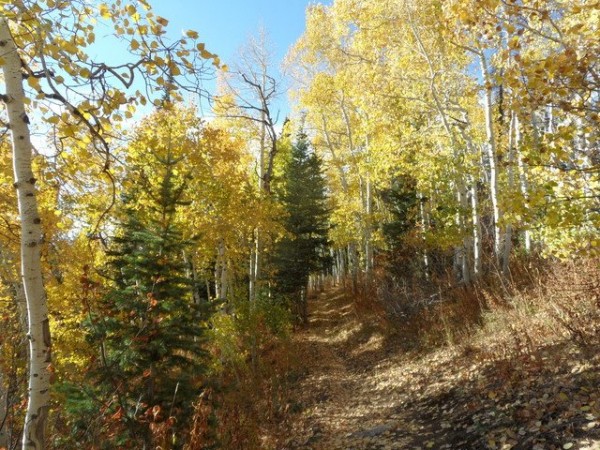
 After seeing the first moose in the pictures above, I headed up Pioneer on my way to Rainbow Saddle and then the gondola. The next 3 photos are all taken in a very similar spot a bit before the uphill trail crosses the Pony Express lifline. That there are no leaves on the trees on 11 Nov is not surprising, but the speed at which the color changed and the leaves dropped was, as shown by the next 2 photos taken less than a week apart, on 15 Oct and 9 Oct.
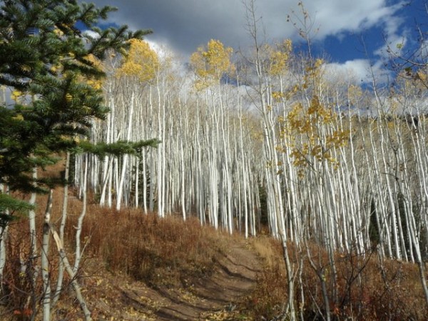
 Also on 9 Oct, the photo on the right was taken on the Elkhead trail.
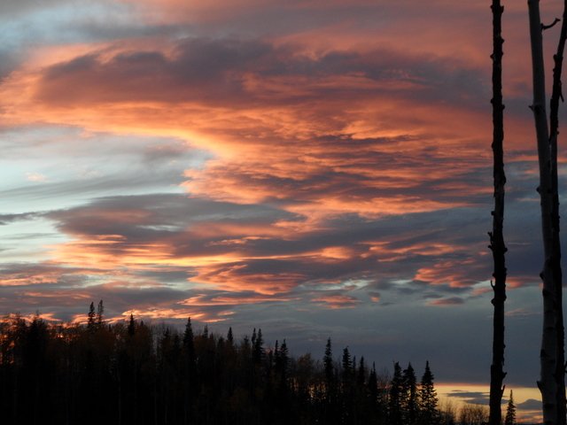
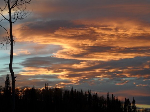 I just can’t resist documenting a nice sunset; the first two were taken on 14 October from the top of Creekside looking south across the Yampa Valley.
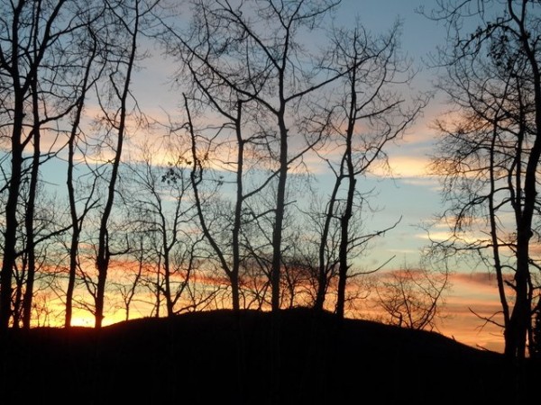 This last photo was taken the next day on 15 October further down the mountain on Gunsmoke.
Another week of warm and mostly sunny ahead of a looming winter-like storm
Thursday, November 10, 2016
Relatively rare gusty easterly winds have developed this afternoon as air is funneled between an indistinct low to our south and a lobe of high pressure to our north that is dragging a weak cool front through the Steamboat Springs area.
Warm temperatures and continued sunny skies with less wind will persist Friday and Saturday before a fast-moving Pacific traveling through the northern tier of states drags a weak cool front through the area on Sunday. There will likely be some clouds during Sunday and even a stray shower is possible, especially at the higher elevations.
Sunny conditions and warm temperatures return for the first half of the work week as a strong winter-like storm approaches the West Coast and pumps up the western ridge. While next Wednesday may be the warmest day of the week, southwesterly winds will increase through the day and become strong as the Pacific storm crosses the California coast.
The storm is forecast to race across the Great Basin Wednesday night and bring a sharp cold front through our area during the day on Thursday. If snow does not fall in the valley during the day, it should turn to snow by sunset as temperatures plummet from the unseasonably warm temperatures we have been enjoying this fall. If forecasts hold, there will be significant snow accumulation on the hill, possibly in the 6-12” range as well as accumulating snow in the valley.
A transitory ridge is advertised for the next weekend before additional energy in the Pacific approaches the West Coast.
Gorgeous late fall weather continues
Monday, November 7, 2016
A high amplitude western ridge will continue our spectacular weather through at least the next week. Temperatures will warm even more for Tuesday and Wednesday as the heart of the ridge moves over the Rockies before a Pacific storm moving along the Canadian border drags a dry cool front through the Steamboat Springs area sometime on Thursday.
Meanwhile, some energy left behind from this past weekend’s storm moves southwestward from it’s current position in Kansas and ends up along the Mexican border for Wednesday and Thursday. Colorado will be sandwiched between these two systems later Thursday and part of Friday leading to cooler temperatures with the possibility of cloudy conditions for a while.
But the ridge rebuilds for later Friday and Saturday once again bringing warm and sunny conditions to our area.
Another weak wave moving along the Canadian border this weekend may bring another dry and even weaker cool front through northern Colorado later Saturday, but temperatures quickly rebound for later Sunday and into the beginning of the next work week.
Dry weather persists except for a chance of light showers for Saturday
Thursday, November 3, 2016
After a couple of gorgeous days to end this work week, moisture increases starting later Friday and hangs around through Saturday night as the wobbly low mentioned in the last forecast moves near the Steamboat Springs area and brings precipitation to southern Colorado. Low temperature for both nights will be warmer than the past few days as the clouds act like a blanket to trap the earth’s daytime heat while daytime highs for Saturday will be cooler as the clouds block the sun.
There may be enough moisture for a chance of rain showers Saturday afternoon and evening especially at the higher elevations.
Clouds may hang around for Sunday and part of Monday with little chance for precipitation as a weak and splitting Pacific weather system crosses Colorado. For those keeping score, the European ECMWF was the clear winner in minimizing the significance of the system.
By Tuesday, the western ridge expands, shunting any Pacific weather systems to our north and bringing another warm and dry work week to the Intermountain West.
There is a chance of some weather for next weekend, though the European ECMWF is once again weaker with the trough and stronger with the western ridge than the American GFS.


